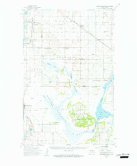
1950 Map of Grahams Island
USGS Topo · Published 1959About this map
Grahams Island and the complex northern reaches of Devils Lake dominate this mid-century survey of the Benson and Ramsey county line. The landscape is defined by the recession and expansion of water levels, leaving distinctive features like Oswalds Bay, West Bay, and Sixmile Bay separated by low-lying peninsulas. An Old Military Reservation Boundary cuts across the island, marking a legacy of federal land use alongside the Sullys Hill National Game Preserve and Mavvais Coulee National Wildlife Refuge.
Find a feature on this map
46 named features on this map. Tap any name to fly to it.
Don’t see what you’re looking for? This feature index may not catch every label — zoom into the map to look around manually.
Map Details
Editions of this 1950 Grahams Island Map
2 editions found
Other maps of this area

1928 · Tokio
USGS Topo · 1:62,500

1931 · Oberon
USGS Topo · 1:62,500

1931 · Tokio
USGS Topo · 1:62,500

1931 · Devils Lake
USGS Topo · 1:62,500

1932 · Flora
USGS Topo · 1:62,500

1932 · Grahams Island
USGS Topo · 1:62,500

1950 · Grahams Island
USGS Topo · 1:62,500

1950 · Devils Lake
USGS Topo · 1:62,500

1950 · Oberon
USGS Topo · 1:62,500

1951 · Crow Hill
USGS Topo · 1:24,000