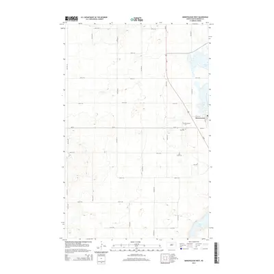
2014 Map of Minnewaukan West
USGS Topo · Published 2014About this map
Minnewaukan serves as the focal point of this Benson County landscape, situated where the prairies of North Dakota meet the receding western reaches of Devils Lake. The map details a strictly organized agricultural grid, with section lines defined by routes like 58th Ave NE and 47th St NE. This layout reflects the late 20th-century rural infrastructure, where modern highways like Nd-19 intersect with traces of earlier transit, such as Old ND-19. Evidence of the area's early pioneer and community heritage is found in several historic burial grounds scattered across the township, including Minnewaukan Cem, Saint Peter Cem, and Free Church Cem. To the south, the terrain descends toward the seasonal waters of Long Lake, illustrating the closed-basin drainage patterns characteristic of the Devils Lake Basin.
Find a feature on this map
25 named features on this map. Tap any name to fly to it.
Don’t see what you’re looking for? This feature index may not catch every label — zoom into the map to look around manually.
Map Details
Editions of this 2014 Minnewaukan West Map
This is the sole edition of this map. No revisions or reprints were ever made.
Other maps of this area

1931 · Oberon
USGS Topo · 1:62,500

1932 · Flora
USGS Topo · 1:62,500

1932 · Grahams Island
USGS Topo · 1:62,500

1950 · Grahams Island
USGS Topo · 1:62,500

1950 · Oberon
USGS Topo · 1:62,500

1951 · Oberon
USGS Topo · 1:24,000

1951 · Tilden
USGS Topo · 1:24,000

1951 · Minnewaukan East
USGS Topo · 1:24,000

1951 · Flora
USGS Topo · 1:24,000

1951 · Josephine
USGS Topo · 1:24,000