1970s Maps of Golden Valley County, North Dakota
Explore 19 historic maps of Golden Valley County from the 1970s. These maps offer a rare glimpse into what life looked like during the 1970s — showing old roads, neighborhoods, homes, and landmarks that have changed or disappeared over time.
Whether you're researching your family's past, planning a metal detecting trip, or studying how Golden Valley County's landscape evolved across the 1970s, these high-resolution maps are a powerful tool for exploring the history of this region.
- Focus on a specific era: All maps on this page are from the 1970s, giving you a focused view of this time period.
- See what’s changed: Compare century-old streets, trails, and buildings to today's modern landscape using overlays and satellite layers.
- Research with precision: Use these maps for genealogy, historical research, land use analysis, or educational projects.
- View, download, or print: Maps are fully viewable online in high resolution, and can be downloaded or printed for your own records.
Start exploring Golden Valley County's history through authentic maps from the 1970s. This is your window into the past.
Golden Valley County, ND maps
(19)- 1970 Map of Eagle Draw, 1972 Print
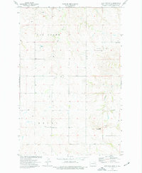
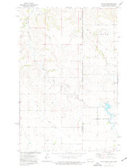
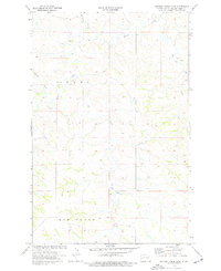
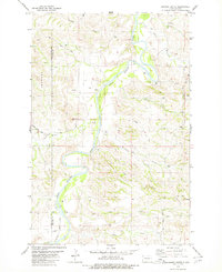
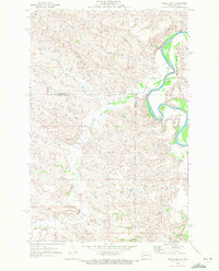 1970 Eagle Draw1972 Print · USGSNorthwestern North Dakota's badlands terrain is captured here at the start of the 1970s where three counties meet. Genealogists and researchers can trace drainage systems like Beaver Creek and Morgan Draw alongside the meandering Little Missouri River.
 - 1970 Map of Medora, 1973 Print
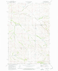
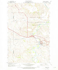 1970 Medora1973 Print · USGSMedora and the surrounding badlands are captured here during the early seventies as the region balanced its ranching roots with growing tourism. Researchers can trace the legacy of the Marquis de Mores at the Chateau de Mores or locate the Medora Cem and the winding Little Missouri River.
 - 1974 Map of Hootowl Creek West, 1977 Print
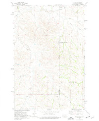
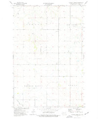
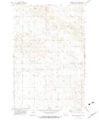
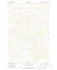 1974 Hootowl Creek West1977 Print · USGSGolden Valley County's western plains are captured here in the mid-seventies, showing a landscape defined by water and ranching. Genealogists and historians can trace the boundaries of Henry and Pearl or locate landmarks like the Flowing Well and Gravel Pit.
 - 1974 Map of Trotters SE, 1977 Print
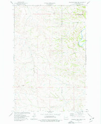
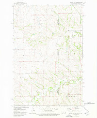
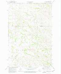 1974 Trotters SE1977 Print · USGSThe high plains of the North Dakota borderlands were meticulously documented during the mid-1970s, showing the complex drainage of McKenzie and Golden Valley counties. Researchers can trace the winding paths of Porcupine Creek and Beaver Creek or locate isolated industrial markers like the Drill Hole near Dietz Draw.
 - 1974 Map of West Twin Butte, 1977 Print
 1974 West Twin Butte1977 Print · USGSGolden Valley County in the mid-1970s shows a landscape of high buttes and drainage basins before modern oil development. Genealogists and local historians can locate Plain View Cem, the Westerheim Sch, and early excavations like the Scoria Pit.
 - 1974 Map of Trotters, 1977 Print
 1974 Trotters1977 Print · USGSThe western North Dakota badlands of Golden Valley and McKenzie counties are captured here in the mid-1970s. Local researchers can locate the South Side Cemetery, the central Townhall, and several scoria pits near the settlement of Trotters.
 - 1974 Map of Skaar, 1977 Print
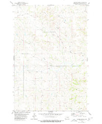
 1974 Skaar1977 Print · USGSThe Montana and North Dakota borderlands come into focus in the mid-1970s, showing a landscape shaped by creek drainage and scoria mining. Researchers can trace the rural settlement of Skaar and local extraction sites like the Scoria Pits near Henry Creek.
 - 1974 Map of Roosevelt Creek West, 1977 Print
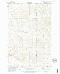
 1974 Roosevelt Creek West1977 Print · USGSThe Badlands of Golden Valley and Billings County are captured here in the mid-1970s, featuring the iconic Elkhorn Ranch Site. Trace the rugged drainage of the Little Missouri River and landmarks like Cooks Peak.
 - 1974 Map of Odland Dam, 1977 Print
 1974 Odland Dam1977 Print · USGSThe North Dakota-Montana borderlands come into focus in the mid-seventies, showing a landscape defined by the Little Beaver Creek drainage. Researchers can locate the Odland Dam, the Elmwood community Townhall, and local industrial Scoria Pits.
 - 1974 Map of Odland Dam NE, 1977 Print
 1974 Odland Dam NE1977 Print · USGSThe high plains along the Montana-North Dakota border come alive in this mid-seventies survey. Genealogists and local historians can locate rural landmarks like Arvid Sch and Blue Mountain Cem among the drainages of Dry Beaver Creek.
 - 1974 Map of Hootowl Creek SW, 1977 Print
 1974 Hootowl Creek SW1977 Print · USGSGolden Valley County in the mid-seventies is documented here during a period of quiet ranching and resource extraction. Genealogists and local historians can trace the topography of Elmwood and locate landmarks like the Townhall and Saddle Butte.
 - 1974 Map of Wannagan Creek West, 1977 Print
 1974 Wannagan Creek West1977 Print · USGSThe North Dakota high plains of the mid-1970s are captured here along the border of Golden Valley and Billings counties. Researchers can trace the drainages of Wannagan Creek and Winter Creek or locate landmarks like East Twin Butte.2 unique versions available
 - 1974 Map of Hootowl Creek East, 1977 Print
 1974 Hootowl Creek East1977 Print · USGSGolden Valley County's rural townships are captured here in the mid-1970s, showcasing a landscape defined by its intricate drainage basins. Researchers can trace the meandering paths of Hootowl Creek, locate Bell Lake, or identify local landmarks like the Gravel Pit.
 - 1979 Map of Sentinel Butte SE
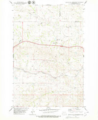
 1979 Sentinel Butte SE1979 Print · USGSThe high plains of Golden Valley County come into focus during the late 1970s, showing a landscape of deep creek forks and scattered ranching infrastructure. Researchers can locate remote landmarks like the Landing Strip and named rural routes such as Garner Creek Road.
 - 1979 Map of Buffalo Gap Campground
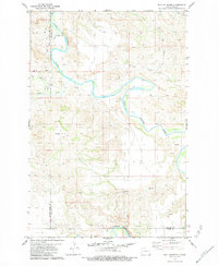
 1979 Buffalo Gap Campground1979 Print · USGSThe North Dakota badlands at the edge of Golden Valley and Billings counties are captured here in the late seventies. You can trace the Burlington Northern rail line through Rider or locate the Buffalo Gap Campground and local Oil Well sites.
 - 1979 Map of Three V Crossing
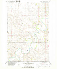 1979 Three V Crossing1979 Print · USGSThe ranching country of western North Dakota is captured here in the late seventies as the river winds through the county line. Researchers can locate remote landmarks like the Three V Ranch, the river ford at Three V Crossing, and various water sources including Deer Creek.
 - 1979 Map of Chimney Butte, 1980 Print
 1979 Chimney Butte1980 Print · USGSThe North Dakota Badlands come into sharp focus in the late seventies, showing the rugged topography where the Little Missouri River meets an expanding oil industry. Researchers can trace land use through scattered Oil Wells and find geographic landmarks like Chimney Butte and Tracy Mtn.
 - 1979 Map of Square Butte, 1980 Print
 1979 Square Butte1980 Print · USGSGolden Valley County in the late seventies was a landscape of high buttes and rural energy development. Genealogists and historians can trace the paths of South Square Butte Road and locate various Oil Wells and landmarks like Square Butte.
 - 1979 Map of Bullion Butte, 1984 Print
 1979 Bullion Butte1984 Print · USGSThe North Dakota badlands come alive in this 1970s survey, dominated by the massive Bullion Butte and the winding Little Missouri River. Genealogists and local historians can locate the Connell Cem and trace old access routes like Pipeline Road.
End of results
Showing maps 1-19 of 19
Top cities of Golden Valley County
Frequently asked questions
- What are the different types of historical maps available for Golden Valley County?
- What is the oldest map of Golden Valley County?
- Where can I purchase historical maps of Golden Valley County for my home or office?
- Where can I download high-res historical maps of Golden Valley County?
- Are there historical topographic maps available for Golden Valley County?
- Is there historical aerial imagery available for Golden Valley County?
- Where are historical maps of Golden Valley County sourced from?