
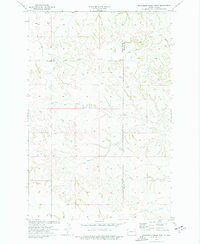
1974 Map of Wannagan Creek West
USGS Topo · Published 1977About this map
Wannagan Creek and its complex network of tributaries define the high plains landscape where the border of Golden Valley Co meets Billings Co. This mid-1970s survey by the U.S. Geological Survey and the State of North Dakota Water Commission reveals a region dominated by drainage patterns and landforms rather than human settlements. The map highlights the rugged topography of the area, punctuated by prominent features such as East Twin Butte and the winding paths of Little Wannagan Creek and Crooked Creek. Scattered water resources, simply labeled as Well, suggest the grazing and agricultural utility of this open country. The absence of towns or major infrastructure emphasizes the quiet, pastoral character of these North Dakota badlands during this era.
Find a feature on this map
7 named features on this map. Tap any name to fly to it.
Don’t see what you’re looking for? This feature index may not catch every label — zoom into the map to look around manually.
Map Details
Editions of this 1974 Wannagan Creek West Map
2 editions found
Other maps of this area

1953 · Dickinson
USGS Topo · 1:250,000

1953 · Watford City
USGS Topo · 1:250,000

1957 · Dickinson
USGS Topo · 1:250,000

1957 · Watford City
USGS Topo · 1:250,000

1967 · Watford City
USGS Topo · 1:250,000

1970 · Wannagan Creek East
USGS Topo · 1:24,000

1970 · Roosevelt Creek East
USGS Topo · 1:24,000

1970 · Medora
USGS Topo · 1:24,000

1974 · West Twin Butte
USGS Topo · 1:24,000

1974 · Roosevelt Creek West
USGS Topo · 1:24,000