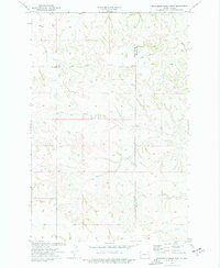
1974 Map of Wannagan Creek West
USGS Topo · Published 1977About this map
Wannagan Creek and its southern counterpart, Little Wannagan Creek, carve through the expansive badlands landscape along the boundary of Golden Valley and Billings counties. This mid-1970s survey illustrates a largely unpopulated ranching and grazing region where water sources are the primary landmarks. In the southwest, the distinctive landform of East Twin Butte rises above the surrounding drainage networks, serving as a prominent geographical anchor. The map reveals the intricate dendritic drainage patterns formed by Winter Creek and Crooked Creek, highlighting the erosional character of this North Dakota terrain. Remote and primarily defined by its hydrology, the area includes occasional wells that supported the agricultural and livestock operations of the time, documenting a moment in the state's rural development before significant modern changes.
Find a feature on this map
8 named features on this map. Tap any name to fly to it.
Don’t see what you’re looking for? This feature index may not catch every label — zoom into the map to look around manually.
Map Details
Editions of this 1974 Wannagan Creek West Map
2 editions found

Other maps of this area

1953 · Dickinson
USGS Topo · 1:250,000

1953 · Watford City
USGS Topo · 1:250,000

1957 · Dickinson
USGS Topo · 1:250,000

1957 · Watford City
USGS Topo · 1:250,000

1967 · Watford City
USGS Topo · 1:250,000

1970 · Wannagan Creek East
USGS Topo · 1:24,000

1970 · Roosevelt Creek East
USGS Topo · 1:24,000

1970 · Medora
USGS Topo · 1:24,000

1974 · West Twin Butte
USGS Topo · 1:24,000

1974 · Roosevelt Creek West
USGS Topo · 1:24,000