Old Maps of Billings County, North Dakota
Explore 231 old maps of Billings County, spanning from 1953 to today. These high-resolution historic maps reveal how streets, neighborhoods, landmarks, and natural features evolved over time — perfect for genealogy, metal detecting, research, and local history exploration.
What you can do with these maps:
- See how Billings County changed over time: Compare historical maps to modern-day views to trace roads, homesites, rail lines & more.
- View detailed metadata: Each map includes creators, publishers, year, scale, and archive source.
- Overlay maps with satellite & LiDAR: Visualize the past alongside modern tools to explore terrain & human change.
- Trusted historical sources: Maps sourced from the USGS, Library of Congress, and other archives.
- Access maps your way: View online, download high-res files, or order prints for personal or research use.
Start exploring old maps of Billings County to uncover forgotten places, hidden landmarks, and the deep history beneath your feet.
Billings County, ND maps
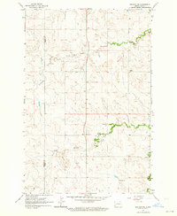
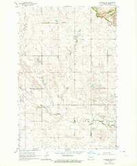
(231)- 1953 Map of Dickinson, 1968 Print
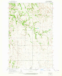
 1953 Dickinson1968 Print · USGSWestern North Dakota in the fifties remains a landscape of rail-linked prairie towns and rugged badlands. Trace the local impact of the Northern Pacific railroad through Dickinson or locate early rural landmarks like Rainy Butte Church and Boys Ranch.2 unique versions available
 - 1953 Map of Watford City, 1968 Print
 1953 Watford City1968 Print · USGSNorth Dakota's badlands and the Missouri River basin are captured here during the 1950s and 60s as the Garrison Dam changed the landscape. Researchers can trace old rail lines like the Great Northern or find rural outposts such as Grassy Butte and Halliday.3 unique versions available
 - 1957 Map of Dickinson
 1957 Dickinson1957 Print · USGSSouthwestern North Dakota in the mid-fifties is a landscape of coal mining and tight-knit rural school districts. Genealogists can trace family footprints through numerous country schools like Fisher School and parish churches like St Stephens.
 - 1957 Map of Watford City
 1957 Watford City1957 Print · USGSWestern North Dakota's landscape is captured here during the mid-fifties as the Missouri River valley undergoes massive change following the creation of Garrison Reservoir. Genealogists and historians can trace dozens of rural schools like Divide School and early settlements such as Arnegard and Grassy Butte.
 - 1961 Map of Daglum, 1963 Print
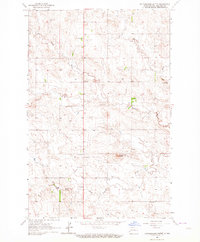
 1961 Daglum1963 Print · USGSThe western North Dakota plains near the turn of the 1960s reveal a landscape of remote schoolhouses and prairie churches. Researchers can locate vanished rural landmarks like Fisher School, the Daglum Cemetery, and Our Lady of Lourdes Ch.
 - 1961 Map of Rocky Ridge, 1963 Print
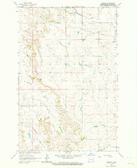
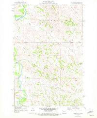
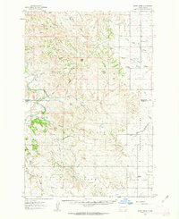 1961 Rocky Ridge1963 Print · USGSThe North Dakota badlands of Slope and Billings Counties are captured here in the early sixties, showing a landscape of ranching and early energy extraction. Researchers can locate the Rocky Ridge Sch, White Lake Sch No 1, and the unique Burning Coal Veins near the river.
 - 1962 Map of Tracy Mountain, 1964 Print
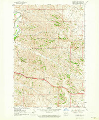
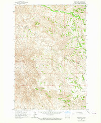
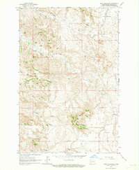 1962 Tracy Mountain1964 Print · USGSBillings County in the early sixties is shown here as a rugged landscape of rail transport and resource extraction. Researchers can trace the Northern Pacific line past Sully Springs or locate the State Experiment Station and various Scoria Pits.2 unique versions available
 - 1962 Map of Fryburg NE, 1964 Print
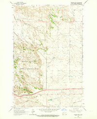 1962 Fryburg NE1964 Print · USGSBillings County is captured in the early sixties as modern highways and energy extraction began to reshape the western North Dakota badlands. Genealogists and historians can locate old homesteads like Lindbo Ranch and trace the original Northern Pacific rail line near Painted Canyon.2 unique versions available
 - 1962 Map of Belfield NE, 1964 Print
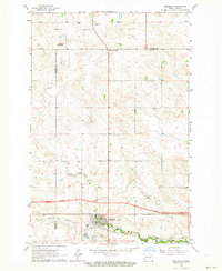
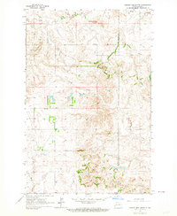
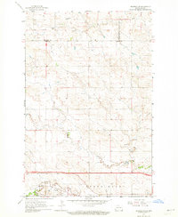 1962 Belfield NE1964 Print · USGSThe high plains of Stark and Billings counties are captured here in the early sixties, showing the rail-centered community of Zenith. Researchers can trace the extractive history of the region through labeled sites like Walters Mine, Karsky Mine, and several local Scoria Pits.2 unique versions available
 - 1962 Map of Belfield SW, 1964 Print
 1962 Belfield SW1964 Print · USGSStark County's high plains and river valleys come into focus during the early sixties, showing the rural structure of the North Dakota badlands border. Researchers can trace historic local education sites like Belfield Sch No 1 and mining features such as the Scoria Pits.
 - 1962 Map of Fryburg, 1964 Print
 1962 Fryburg1964 Print · USGSBillings County is captured here in the early sixties, showing the vital link between ranching land and the energy industry. Researchers can trace the Northern Pacific rail line and locate industrial landmarks like the Fryburg Oil Field and various Scoria Pits.2 unique versions available
 - 1962 Map of Fryburg NW, 1964 Print
 1962 Fryburg NW1964 Print · USGSThe North Dakota badlands appear in the early sixties as a mix of emerging industry and protected wilderness. Trace the early expansion of the memorial park through landmarks like Burning Coal Vein, the Scoria Oil Field, and the Painted Canyon Overlook.2 unique versions available
 - 1962 Map of Belfield, 1964 Print
 1962 Belfield1964 Print · USGSBelfield and the surrounding plains of the Stark and Billings county line are captured here in the early sixties as new infrastructure began to reshape the region. Researchers can trace the path of the Northern Pacific railroad and locate community sites like St Stanislaus Cem and Truelson Sch.2 unique versions available
 - 1963 Map of Fairfield SE, 1964 Print
 1963 Fairfield SE1964 Print · USGSBillings and Dunn counties are captured in the early 1960s, showing a remote prairie landscape of family farms and ethnic roots. Genealogists can locate rural landmarks such as the Ukrania School, St Demetrius Cemetery, and Barta School.2 unique versions available
 - 1963 Map of Gorham SW, 1964 Print
 1963 Gorham SW1964 Print · USGSBillings County grazing lands and badlands are captured here in the early sixties, as the region maintained its character as a sparse ranching frontier. Researchers can identify isolated landmarks like Stevens Sch, the Scoria Pit, and the northern reaches of Theodore Roosevelt National Memorial Park.2 unique versions available
 - 1963 Map of Gorham NW, 1964 Print
 1963 Gorham NW1964 Print · USGSBillings County is shown during the early sixties as a rugged landscape defined by its complex drainage systems. Geologists and local researchers can trace the winding paths of Whitetail Creek and Blacktail Creek or locate the site of a rural Scoria Pit.
 - 1963 Map of Fairfield, 1964 Print
 1963 Fairfield1964 Print · USGSBillings County's rural ranching and farming landscape is captured in the early 1960s, centered on the community of Fairfield. Genealogists can trace local landmarks like the Immaculate Conception Cem and a network of district schools, including Hecker Sch and Glade Sch.2 unique versions available
 - 1963 Map of Gorham SE, 1964 Print
 1963 Gorham SE1964 Print · USGSBillings County territory is captured in the early sixties as a landscape of isolated schoolhouses and winding creek breaks. Genealogists and local historians can locate the exact sites of Gorham Sch and Pioneer Sch or trace the course of Franks Creek.
 - 1963 Map of Gorham, 1964 Print
 1963 Gorham1964 Print · USGSBillings County, North Dakota, is documented in the early sixties as a region of remote prairie settlements and winding creek beds. Genealogists can trace rural community life through the locations of St Jacobs Cem, Pioneer Sch No 1, and the church at Gorham.
 - 1963 Map of Rattlesnake Butte, 1964 Print
 1963 Rattlesnake Butte1964 Print · USGSWestern North Dakota ranchlands are documented here in the early sixties, showing a rural landscape organized around the Green River. Genealogists can locate family landmarks like St Marys Cem, St Demetrius Ch, and several rural schoolhouses.2 unique versions available
 - 1963 Map of Hungry Man Butte, 1964 Print
 1963 Hungry Man Butte1964 Print · USGSThe high plains along the Billings and Dunn county line appear here in the early sixties, showing a landscape of ranching and remote schoolhouses. Researchers can trace the Knife River and Crooked Creek drainages or locate the Snow Sch and Hungry Man Butte.
 - 1967 Map of Watford City
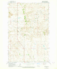
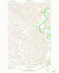
 1967 Watford City1967 Print · USGSWestern North Dakota is captured during a period of landscape transformation as the Missouri River valley was reshaped by the new Garrison Reservoir. Genealogists and local historians can trace the foundations of Watford City, find the Elkhorn Ranch Site, or locate rural landmarks like Ziner Butte and Grassy Butte.
 - 1970 Map of Eagle Draw, 1972 Print
 1970 Eagle Draw1972 Print · USGSNorthwestern North Dakota's badlands terrain is captured here at the start of the 1970s where three counties meet. Genealogists and researchers can trace drainage systems like Beaver Creek and Morgan Draw alongside the meandering Little Missouri River.
 - 1970 Map of Hanks Gully, 1972 Print
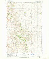
 1970 Hanks Gully1972 Print · USGSThe North Dakota Badlands in the early 1970s are defined by the winding Little Missouri River and the complex terrain of Rhoades. Geologists and researchers can trace the drainage patterns of Magpie Creek or locate landmarks like Buckhorn Butte and the local Oil Well.2 unique versions available
 - 1970 Map of Wannagan Creek East, 1972 Print
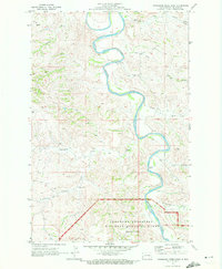 1970 Wannagan Creek East1972 Print · USGSBillings County is revealed in the early 1970s as a land of serpentine river bends and remote parkland. Genealogists and local historians can trace the rural landscape near the Myers Sch and the Petrified Forest within the Theodore Roosevelt National Memorial Park.
Showing maps 1-25 of 231
Top cities of Billings County
Frequently asked questions
- What are the different types of historical maps available for Billings County?
- What is the oldest map of Billings County?
- Where can I purchase historical maps of Billings County for my home or office?
- Where can I download high-res historical maps of Billings County?
- Are there historical topographic maps available for Billings County?
- Is there historical aerial imagery available for Billings County?
- Where are historical maps of Billings County sourced from?