
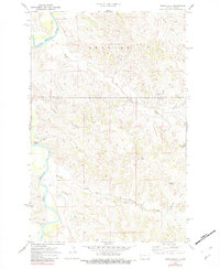
1970 Map of Hanks Gully
USGS Topo · Published 1972About this map
The Little Missouri River meanders through this portion of the Badlands, defining a landscape of deeply eroded drainage systems and prominent landmarks. The boundary between McKenzie and Billings County crosses the central portion of the map, where the terrain is dominated by the plateaus and ridges of Rhoades. Numerous creeks, including Magpie Creek, Whitetail Creek, and Buckhorn Creek, carve through the earth to feed the river, creating the intricate network of coulees characteristic of western North Dakota.
Find a feature on this map
17 named features on this map. Tap any name to fly to it.
Don’t see what you’re looking for? This feature index may not catch every label — zoom into the map to look around manually.
Map Details
Editions of this 1970 Hanks Gully Map
2 editions found
Other maps of this area

1953 · Watford City
USGS Topo · 1:250,000

1957 · Watford City
USGS Topo · 1:250,000

1963 · Gorham NW
USGS Topo · 1:24,000

1967 · Watford City
USGS Topo · 1:250,000

1970 · Eagle Draw
USGS Topo · 1:24,000

1970 · Roosevelt Creek East
USGS Topo · 1:24,000

1974 · Wolf Coulee
USGS Topo · 1:24,000

1974 · Squaretop Butte
USGS Topo · 1:24,000

1974 · Roosevelt Creek West
USGS Topo · 1:24,000
1974 · Ice Box Canyon
USGS Topo · 1:24,000