Old Maps of McKenzie County, North Dakota
Explore 559 old maps of McKenzie County, spanning from 1909 to today. These high-resolution historic maps reveal how streets, neighborhoods, landmarks, and natural features evolved over time — perfect for genealogy, metal detecting, research, and local history exploration.
What you can do with these maps:
- See how McKenzie County changed over time: Compare historical maps to modern-day views to trace roads, homesites, rail lines & more.
- View detailed metadata: Each map includes creators, publishers, year, scale, and archive source.
- Overlay maps with satellite & LiDAR: Visualize the past alongside modern tools to explore terrain & human change.
- Trusted historical sources: Maps sourced from the USGS, Library of Congress, and other archives.
- Access maps your way: View online, download high-res files, or order prints for personal or research use.
Start exploring old maps of McKenzie County to uncover forgotten places, hidden landmarks, and the deep history beneath your feet.
McKenzie County, ND maps
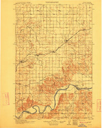
(559)- 1909 Map of Glendive
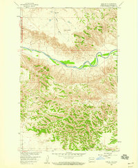
 1909 Glendive1909 Print · USGSThe confluence of the Missouri and Yellowstone rivers in the first decade of the twentieth century shows a region of scattered ranches and emerging river towns. Genealogists can trace family landmarks like Cavanaughs Ranch or Nortons Ranch and find early resource sites like the Coal Mine.
 - 1911 Map of Ray
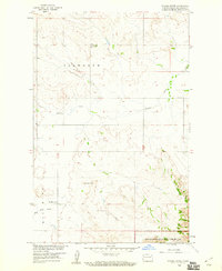
 1911 Ray1911 Print · USGSNorthwest North Dakota at the height of the homesteading era reveals a landscape defined by the iron rails and the wide Missouri. Genealogists and researchers can trace the early rail stops like Wheelock and Epping or locate river landmarks such as Nesson Ferry and Banks.2 unique versions available
 - 1953 Map of Williston, 1968 Print
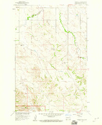
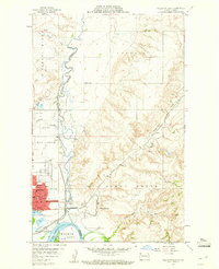
 1953 Williston1968 Print · USGSThe North Dakota high plains meet the waters of Sakakawea Lake in this mid-century survey of the northern borderlands. Trace the rail-and-ranch economy through sites like Anderson Sky Ranch, Sevenmile Corner, and the strip mines near Columbus.2 unique versions available
 - 1953 Map of Watford City, 1968 Print
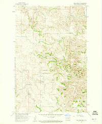
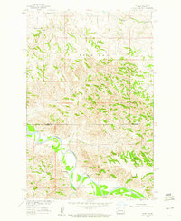
 1953 Watford City1968 Print · USGSNorth Dakota's badlands and the Missouri River basin are captured here during the 1950s and 60s as the Garrison Dam changed the landscape. Researchers can trace old rail lines like the Great Northern or find rural outposts such as Grassy Butte and Halliday.3 unique versions available
 - 1954 Map of Glendive, 1967 Print
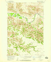
 1954 Glendive1967 Print · USGSEastern Montana at mid-century shows a landscape of river-valley commerce and remote prairie ranching. Researchers can trace the legacy of rural education and transport through sites like Prairie Elk School, the Great Northern rail lines, and Circle.2 unique versions available
 - 1957 Map of Glendive
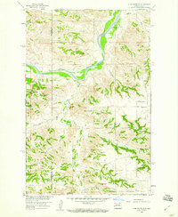
 1957 Glendive1957 Print · USGSEastern Montana in the mid-1950s is defined by its deep river valleys and a sprawling network of rural school districts. You can trace the path of the Great Northern railroad and locate vanished local landmarks like Breezy Flat School and Newton Junction.
 - 1957 Map of Williston
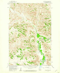
 1957 Williston1957 Print · USGSNorthwestern North Dakota is shown here during the mid-fifties, dominated by the sweeping plains and the Missouri River valley. Genealogists and local historians can trace the paths of the Great Northern railroad through Williston, Tioga, and Ray, or locate early industry like the coal strip mines near Lignite.
 - 1957 Map of Watford City
 1957 Watford City1957 Print · USGSWestern North Dakota's landscape is captured here during the mid-fifties as the Missouri River valley undergoes massive change following the creation of Garrison Reservoir. Genealogists and historians can trace dozens of rural schools like Divide School and early settlements such as Arnegard and Grassy Butte.
 - 1958 Map of Glendive
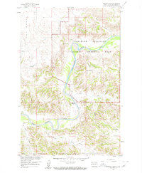
 1958 Glendive1958 Print · USGSEastern Montana and the North Dakota borderlands come alive in the late fifties, showing the agricultural heart of the Yellowstone valley. Trace the legacy of rural education through Kimmel School and Ridgelawn School or locate rail hubs in Glendive and Sidney.
 - 1958 Map of Long X Divide, 1960 Print
 1958 Long X Divide1960 Print · USGSThe North Dakota Badlands come alive in this late-fifties survey of the Little Missouri River and the Theodore Roosevelt National Memorial Park. Researchers can trace old rural school sites like Clifton Sch and the high ridges of the Long X Divide.2 unique versions available
 - 1958 Map of Lone Butte SE, 1960 Print
 1958 Lone Butte SE1960 Print · USGSDunn and McKenzie counties show their rugged ranching character in the late 1950s as they are mapped for the Missouri River Basin project. Genealogists and historians can locate family landmarks like the Erickson Ranch, Olson Ranch, and the Quilliam Sch.2 unique versions available
 - 1958 Map of Sperati Point, 1960 Print
 1958 Sperati Point1960 Print · USGSThe North Dakota badlands appear in striking detail during the late fifties as the Little Missouri River snakes through the landscape. Researchers can locate remote homesteads like the Kellogg Ranch and family-named landmarks such as the Achenback Hills.2 unique versions available
 - 1958 Map of Lone Butte, 1960 Print
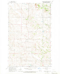
 1958 Lone Butte1960 Print · USGSMcKenzie County was a landscape of remote ranches and isolated buttes in the late fifties. You can trace the rugged drainages of the Little Missouri River and locate historic sites like Murray Ranch and the Hovet Sch.2 unique versions available
 - 1958 Map of Stocke Butte, 1960 Print
 1958 Stocke Butte1960 Print · USGSMcKenzie County in the late fifties showcases a quiet ranching landscape on the edge of the Badlands. Genealogists and local historians can locate the Zoar Ch, trace the Red Wing Sch, and explore the northern boundary of Theodore Roosevelt National Memorial Park.2 unique versions available
 - 1958 Map of Tepee Buttes, 1960 Print
 1958 Tepee Buttes1960 Print · USGSMcKenzie County in the late fifties shows a rural North Dakota landscape transitioning into a protected wilderness. Researchers can trace early school sites like Cherry Sch and landmarks such as Stony Johnny Butte or the Tepee Buttes Cem.2 unique versions available
 - 1959 Map of Lone Butte NW, 1960 Print
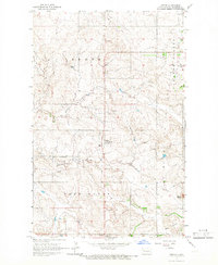
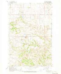
 1959 Lone Butte NW1960 Print · USGSMcKenzie County ranchlands are captured here in the late fifties during a period of Missouri River Basin development. Genealogists and local historians can locate remote community landmarks like Spring Creek Ch, Wonderland Sch, and the Cem.
 - 1959 Map of Croff, 1960 Print
 1959 Croff1960 Print · USGSMcKenzie County was a landscape of remote cattle operations and small rural outposts during the late fifties. Genealogists and local historians can trace the locations of the Croff Sch, the Kennedy Ranch, and the path of the Little Missouri River.
 - 1959 Map of Williston East, 1960 Print
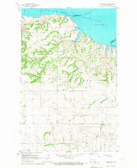
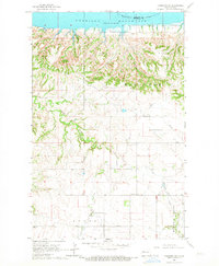
 1959 Williston East1960 Print · USGSWilliston and the Missouri River valley appear at a moment of transition in the late fifties as the Garrison Lake reservoir begins to fill. Genealogists and historians can locate numerous rural schoolhouses like Palmer Sch and Stony Creek Sch or trace the development of Williston near the Wright Airport.2 unique versions available
 - 1959 Map of Lone Butte NE, 1961 Print
 1959 Lone Butte NE1961 Print · USGSMcKenzie and Dunn Counties appear here in the late fifties as a landscape of isolated ranching and river breaks. Genealogists and researchers can trace family-named sites like Johnson Ranch or Mandal Ranch and landmarks like Haystack Butte along the Little Missouri River.2 unique versions available
 - 1965 Map of Keene, 1966 Print
 1965 Keene1966 Print · USGSMcKenzie County ranching country comes into focus in the mid-1960s, showing the isolated community of Keene and its surrounding prairie. Researchers can trace rural life through the Hawkeye Sch, the Adventist Ch, and landmarks like Blue Butte.
 - 1965 Map of Johnsons Corner, 1966 Print
 1965 Johnsons Corner1966 Print · USGSMcKenzie County's high plains are documented here in the mid-1960s as the regional energy economy began to shape the landscape. Researchers can trace local lineage at Silent City Cem or Union Cem and locate industrial landmarks like the Blue Butte Oil and Gas Field.
 - 1965 Map of Charlson, 1966 Print
 1965 Charlson1966 Print · USGSMcKenzie County in the mid-1960s reveals a prairie landscape transitioning into an industrial energy hub. Genealogists and historians can locate the Charlson settlement, remote burial sites like Riverside Cem, and the extensive Oil and Gas Field.
 - 1965 Map of Blue Buttes, 1966 Print
 1965 Blue Buttes1966 Print · USGSMcKenzie County was a landscape of remote ranchlands and emerging energy extraction in the mid-sixties. Genealogists and historians can locate rural landmarks like Redeemer Cem, Reservation Sch, and the high peaks of Chimney Butte.
 - 1965 Map of Charlson SW, 1967 Print
 1965 Charlson SW1967 Print · USGSMcKenzie County was undergoing an industrial transformation in the mid-1960s as petroleum extraction expanded across the Missouri River breaks. Genealogists and historians can locate the Good Hope Ch and trace the early development of the Charlson Oil Field and Hawkeye Valley Oil Field.
 - 1965 Map of Charlson NE, 1967 Print
 1965 Charlson NE1967 Print · USGSMountrail and Williams Counties meet at the edge of the Garrison Reservoir during the mid-sixties. Researchers can trace the original path of the Missouri River and explore terrain features like Dry Fork and Elm Tree.
Showing maps 1-25 of 559
Top cities of McKenzie County
- Watford City historical maps
- Arnegard historical maps
- Alexander historical maps
- Hawkeye historical maps
- Keene historical maps
Frequently asked questions
- What are the different types of historical maps available for McKenzie County?
- What is the oldest map of McKenzie County?
- Where can I purchase historical maps of McKenzie County for my home or office?
- Where can I download high-res historical maps of McKenzie County?
- Are there historical topographic maps available for McKenzie County?
- Is there historical aerial imagery available for McKenzie County?
- Where are historical maps of McKenzie County sourced from?