
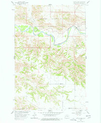
1958 Map of Long X Divide
USGS Topo · Published 1960About this map
The Little Missouri River carves a dramatic path through the northern portion of this landscape, anchoring the boundaries of the Theodore Roosevelt National Memorial Park. This 1958 survey captures the rugged Badlands topography of the region, where the Long X Divide serves as a prominent ridge separating the river drainage from the southern plateaus. The map documents the infrastructure of the Missouri River Basin development program, including a Gaging Station and Ranger Station along the riverbanks near the Squaw Creek Campground. Further south, the rural character of McKenzie County is evident through localized landmarks like the Clifton Sch and Boehm Sch, providing essential geographic markers for genealogists tracing mid-century education and settlement patterns in the North Dakota Badlands.
Find a feature on this map
15 named features on this map. Tap any name to fly to it.
Don’t see what you’re looking for? This feature index may not catch every label — zoom into the map to look around manually.
Map Details
Editions of this 1958 Long X Divide Map
2 editions found
Other maps of this area

1953 · Watford City
USGS Topo · 1:250,000

1957 · Watford City
USGS Topo · 1:250,000

1958 · Sperati Point
USGS Topo · 1:24,000

1958 · Lone Butte
USGS Topo · 1:24,000

1958 · Stocke Butte
USGS Topo · 1:24,000

1958 · Tepee Buttes
USGS Topo · 1:24,000

1959 · Lone Butte NW
USGS Topo · 1:24,000

1967 · Watford City
USGS Topo · 1:250,000

1974 · Wolf Coulee
USGS Topo · 1:24,000

1974 · Buckskin Butte
USGS Topo · 1:24,000