
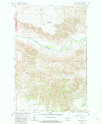
1958 Map of Lone Butte
USGS Topo · Published 1960About this map
The Little Missouri River snakes through the center of this 1950s landscape, illustrating the intricate drainage patterns of the North Dakota badlands before extensive modern development. The map records a sparsely populated ranching environment where landmarks are often defined by isolated summits like Morman Butte and the namesake Lone Butte in the southern reaches. Along the river’s north bank, the Murray Ranch stands as a primary site of habitation, while the Hovet Sch on the northern plateau served the local rural community.
Find a feature on this map
12 named features on this map. Tap any name to fly to it.
Don’t see what you’re looking for? This feature index may not catch every label — zoom into the map to look around manually.
Map Details
Editions of this 1958 Lone Butte Map
2 editions found
Other maps of this area

1953 · Watford City
USGS Topo · 1:250,000

1957 · Watford City
USGS Topo · 1:250,000

1958 · Long X Divide
USGS Topo · 1:24,000

1958 · Lone Butte SE
USGS Topo · 1:24,000

1958 · Tepee Buttes
USGS Topo · 1:24,000

1959 · Lone Butte NW
USGS Topo · 1:24,000

1959 · Lone Butte NE
USGS Topo · 1:24,000

1967 · Watford City
USGS Topo · 1:250,000

1974 · Petes Creek
USGS Topo · 1:24,000

1974 · Buckskin Butte
USGS Topo · 1:24,000