
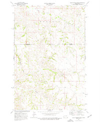
1974 Map of Buckskin Butte
USGS Topo · Published 1977About this map
Teepee Butte and Buckskin Butte dominate this McKenzie County landscape, where the broken terrain of the Badlands is dissected by Bennett Creek and Cottonwood Creek. The map documents the rural infrastructure of the mid-1970s, including the winding Beicegel Creek Road and several industrial extractions such as a Scoria Pit and Gravel Pit. Much of the southern portion of the quadrangle is occupied by the R H O A D E S area, showcasing the complex topography near Grassy Butte. The drainage patterns of Beicegel Creek illustrate how water has carved the high plains, creating a network of draws and ridges essential for local ranching and land management in this portion of western North Dakota.
Find a feature on this map
14 named features on this map. Tap any name to fly to it.
Don’t see what you’re looking for? This feature index may not catch every label — zoom into the map to look around manually.
Map Details
Editions of this 1974 Buckskin Butte Map
This is the sole edition of this map. No revisions or reprints were ever made.
Other maps of this area

1953 · Watford City
USGS Topo · 1:250,000

1957 · Watford City
USGS Topo · 1:250,000

1958 · Long X Divide
USGS Topo · 1:24,000

1958 · Sperati Point
USGS Topo · 1:24,000

1958 · Lone Butte
USGS Topo · 1:24,000

1967 · Watford City
USGS Topo · 1:250,000

1974 · Wolf Coulee
USGS Topo · 1:24,000

1974 · Grassy Butte SW
USGS Topo · 1:24,000

1974 · Squaretop Butte
USGS Topo · 1:24,000
1974 · Scairt Woman Draw
USGS Topo · 1:24,000