
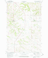
1974 Map of Grassy Butte SW
USGS Topo · Published 1977About this map
Rhoades terrain dominates this 1970s landscape along the border of McKenzie and Billings counties. The geography is defined by the incision of the Little Knife River and a series of drainage systems including Beicegel Creek, Spring Creek, and North Creek. Human settlement is sparse and utilitarian, represented by the Grassy Butte Ch and the rural Ruf Sch, illustrating the dispersed community structure of the North Dakota badlands during this period. Local industry and resource extraction are grounded in the earth, as evidenced by a Scoria Pit located in the southern portion of the quadrangle. The map captures a moment when the regional identity remained tied to grazing land and small-scale community landmarks before modern infrastructure developments further altered the connectivity of these prairie counties.
Find a feature on this map
9 named features on this map. Tap any name to fly to it.
Don’t see what you’re looking for? This feature index may not catch every label — zoom into the map to look around manually.
Map Details
Editions of this 1974 Grassy Butte SW Map
2 editions found
Other maps of this area

1953 · Watford City
USGS Topo · 1:250,000

1957 · Watford City
USGS Topo · 1:250,000

1963 · Fairfield
USGS Topo · 1:24,000

1963 · Gorham
USGS Topo · 1:24,000

1963 · Hungry Man Butte
USGS Topo · 1:24,000

1967 · Watford City
USGS Topo · 1:250,000

1974 · Petes Creek
USGS Topo · 1:24,000

1974 · Buckskin Butte
USGS Topo · 1:24,000
1974 · Scairt Woman Draw
USGS Topo · 1:24,000
1974 · Grassy Butte
USGS Topo · 1:24,000