
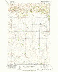
1963 Map of Hungry Man Butte
USGS Topo · Published 1964About this map
Hungry Man Butte anchors this landscape in the western Dakotas, rising above a terrain defined by the drainages of the Knife River and Crooked Creek. This early 1960s survey by the U.S. Geological Survey reveals a sparsely settled frontier along the border of Billings and Dunn counties. The presence of the Snow Sch suggests a rural community centered around local education and ranching, even as the vast majority of the land remains dominated by natural topography and watercourses like Horse Creek. The map provides a look at the section lines and unimproved dirt roads that dictated travel and land ownership in this region of North Dakota before modern infrastructure intensified. Notable landmarks like Rocky Hill served as orientation points for residents navigating the expansive cattle country typical of the era.
Find a feature on this map
7 named features on this map. Tap any name to fly to it.
Don’t see what you’re looking for? This feature index may not catch every label — zoom into the map to look around manually.
Map Details
Editions of this 1963 Hungry Man Butte Map
This is the sole edition of this map. No revisions or reprints were ever made.
Other maps of this area

1953 · Watford City
USGS Topo · 1:250,000

1957 · Watford City
USGS Topo · 1:250,000

1963 · Fairfield SE
USGS Topo · 1:24,000

1963 · Fairfield
USGS Topo · 1:24,000

1963 · Rattlesnake Butte
USGS Topo · 1:24,000

1967 · Watford City
USGS Topo · 1:250,000
1973 · New Hradec North
USGS Topo · 1:24,000

1973 · Manning NW
USGS Topo · 1:24,000

1974 · Killdeer
USGS Topo · 1:100,000

1974 · Grassy Butte SW
USGS Topo · 1:24,000