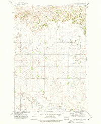
1973 Map of New Hradec North
USGS Topo · Published 1977About this map
New Hradec anchors the southern boundary of this high plains landscape within Dunn County, situated just north of the meandering Green River. The settlement is defined by local institutions like the St Peter and Paul School, while the surrounding prairie is dissected by intermittent waterways including Russian Spring Creek and several unnamed drainages. Topography here is characterized by distinct northern bluffs where Springs are noted along the escarpment, providing a rare water source for the dry upland plateau. Cultural landmarks such as the St Anthony Cem and various resource extraction sites like a Gravel Pit and scattered wells indicate a rural economy focused on agriculture and local materials during the early 1970s.
Find a feature on this map
10 named features on this map. Tap any name to fly to it.
Don’t see what you’re looking for? This feature index may not catch every label — zoom into the map to look around manually.
Map Details
Editions of this 1973 New Hradec North Map
This is the sole edition of this map. No revisions or reprints were ever made.
Other maps of this area

1953 · Dickinson
USGS Topo · 1:250,000

1953 · Watford City
USGS Topo · 1:250,000

1957 · Dickinson
USGS Topo · 1:250,000

1957 · Watford City
USGS Topo · 1:250,000

1959 · Dickinson North
USGS Topo · 1:24,000

1962 · Belfield NE
USGS Topo · 1:24,000

1963 · Fairfield SE
USGS Topo · 1:24,000

1963 · Hungry Man Butte
USGS Topo · 1:24,000

1967 · Watford City
USGS Topo · 1:250,000

1973 · Manning SE
USGS Topo · 1:24,000