
1973 Map of Manning SE
USGS Topo · Published 1977About this map
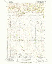
Russian Spring Creek and Spring Creek wind through this rural landscape in Dunn County, highlighting the importance of seasonal water sources in the high plains during the early 1970s. The terrain is defined by a network of drainages including Lighting Creek and Deep Creek, which illustrate the natural erosion patterns across the Manning SE quadrangle. Human impact on the land is represented by scattered industrial and agricultural markers, such as several Gravel Pit locations and a solitary Well in the southeast corner. These features, along with the fine red dashed lines indicating property fence lines, provide a detailed look at land division and resource extraction in North Dakota just before the mid-1970s. The map serves as a clear record of the area's topography as documented by the State Water Commission and federal agencies.
Find a feature on this map
9 named features on this map. Tap any name to fly to it.
Don’t see what you’re looking for? This feature index may not catch every label — zoom into the map to look around manually.
Map Details
Editions of this 1973 Manning SE Map
This is the sole edition of this map. No revisions or reprints were ever made.
Other maps of this area

1953 · Dickinson
USGS Topo · 1:250,000

1953 · Watford City
USGS Topo · 1:250,000

1957 · Dickinson
USGS Topo · 1:250,000

1957 · Watford City
USGS Topo · 1:250,000

1959 · Dickinson North
USGS Topo · 1:24,000

1962 · Davis Buttes
USGS Topo · 1:24,000

1967 · Watford City
USGS Topo · 1:250,000

1973 · New Hradec South
USGS Topo · 1:24,000
1973 · New Hradec North
USGS Topo · 1:24,000
1973 · Hirschville SW
USGS Topo · 1:24,000