
1973 Map of Manning NW
USGS Topo · Published 1977About this map
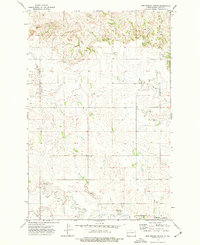
Knife River flows across the northern reaches of this North Dakota landscape, which is defined by the winding course of Crooked Creek as it carves through the central and southern terrain. This 1970s survey, compiled from 1972 aerial photography by the U.S. Geological Survey, reveals a sparsely settled region of Dunn County where the land is primarily organized by the Public Land Survey System. The map documentation shows several locations marked simply as Well, indicating the localized infrastructure required for ranching or resource extraction in this open country. A lone Spring in the western section further illustrates the critical role of water sources in this environment. The topographic detail provided by the State Water Commission and federal agencies highlights the intricate drainage patterns that have shaped the plains.
Find a feature on this map
7 named features on this map. Tap any name to fly to it.
Don’t see what you’re looking for? This feature index may not catch every label — zoom into the map to look around manually.
Map Details
Editions of this 1973 Manning NW Map
This is the sole edition of this map. No revisions or reprints were ever made.
Other maps of this area

1953 · Watford City
USGS Topo · 1:250,000

1957 · Watford City
USGS Topo · 1:250,000

1963 · Fairfield SE
USGS Topo · 1:24,000

1963 · Hungry Man Butte
USGS Topo · 1:24,000

1967 · Watford City
USGS Topo · 1:250,000

1973 · Manning SE
USGS Topo · 1:24,000
1973 · New Hradec North
USGS Topo · 1:24,000

1973 · Manning
USGS Topo · 1:24,000

1974 · Killdeer
USGS Topo · 1:100,000

1974 · Fayette
USGS Topo · 1:24,000