
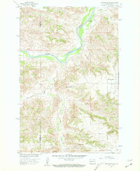
1958 Map of Lone Butte SE
USGS Topo · Published 1960About this map
The Little Missouri River carves a winding path through the broken badlands of the Missouri River Basin at the end of the 1950s. This landscape, straddling the border of McKenzie and Dunn counties, is defined by its deep drainages and isolated grazing operations. Isolated ranches such as the Monroe Ranch and Tysver Ranch are positioned near the few reliable water sources, including Crosby Creek and Cottonwood Creek.
Find a feature on this map
20 named features on this map. Tap any name to fly to it.
Don’t see what you’re looking for? This feature index may not catch every label — zoom into the map to look around manually.
Map Details
Editions of this 1958 Lone Butte SE Map
2 editions found
Other maps of this area

1953 · Watford City
USGS Topo · 1:250,000

1957 · Watford City
USGS Topo · 1:250,000

1958 · Lone Butte
USGS Topo · 1:24,000

1958 · North Killdeer Mountain
USGS Topo · 1:24,000

1959 · Lone Butte NW
USGS Topo · 1:24,000

1959 · Croff
USGS Topo · 1:24,000

1959 · Lone Butte NE
USGS Topo · 1:24,000

1967 · Watford City
USGS Topo · 1:250,000

1974 · Killdeer
USGS Topo · 1:100,000

1974 · Petes Creek
USGS Topo · 1:24,000