
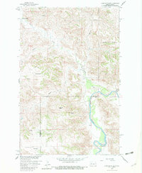
1959 Map of Lone Butte NE
USGS Topo · Published 1961About this map
Little Missouri River bottomlands dominate the eastern edge of this western North Dakota landscape, showing a complex network of breaks and drainages in the late 1950s. The terrain is defined by prominent high points like Haystack Butte and Round Top Butte, while the northern portion is marked by the expansive Bear Den plateau. This area represents the rural ranching economy of McKenzie and Dunn Counties, where isolated homesteads such as Johnson Ranch and Mandal Ranch are situated near vital water sources like Cherry Creek and Elkhorn Creek. The map documents a period of development focused on the Missouri River Basin, capturing the placement of deep-country infrastructure such as a Flowing Well and Rough Creek trails. This record is particularly valuable for tracing historical land use in the rugged Badlands-adjacent territory before modern oil and gas expansion altered the surface character of the region.
Find a feature on this map
14 named features on this map. Tap any name to fly to it.
Don’t see what you’re looking for? This feature index may not catch every label — zoom into the map to look around manually.
Map Details
Editions of this 1959 Lone Butte NE Map
2 editions found
Other maps of this area

1953 · Watford City
USGS Topo · 1:250,000

1957 · Watford City
USGS Topo · 1:250,000

1958 · Lone Butte SE
USGS Topo · 1:24,000

1958 · Lone Butte
USGS Topo · 1:24,000

1958 · North Killdeer Mountain
USGS Topo · 1:24,000

1959 · Lone Butte NW
USGS Topo · 1:24,000

1959 · Croff
USGS Topo · 1:24,000

1965 · Johnsons Corner
USGS Topo · 1:24,000

1967 · Watford City
USGS Topo · 1:250,000

1978 · Schafer
USGS Topo · 1:24,000