
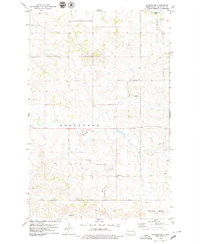
1965 Map of Johnsons Corner
USGS Topo · Published 1966About this map
Johnsons Corner serves as the focal point of this 1960s McKenzie County landscape, where the intersection of rural life and the budding energy industry is clearly defined. The terrain is marked by significant geological formations including the Blue Buttes, Camel Buttes, and the prominent Kummer Ridge. This era shows the expansion of the Blue Butte Oil and Gas Field and the Pershing Oil and Gas Field, interspersed with localized Scoria Pits and an emerging Pipeline network. Genealogists can locate several burial sites serving the area's families, such as the Silent City Cem, Union Cem, and Johnsons Corner Cem. The map provides a detailed view of the drainage patterns through Bear Den Cr and Dry Creek, alongside the established Grail road system.
Find a feature on this map
18 named features on this map. Tap any name to fly to it.
Don’t see what you’re looking for? This feature index may not catch every label — zoom into the map to look around manually.
Map Details
Editions of this 1965 Johnsons Corner Map
This is the sole edition of this map. No revisions or reprints were ever made.
Other maps of this area

1953 · Watford City
USGS Topo · 1:250,000

1957 · Watford City
USGS Topo · 1:250,000

1959 · Croff
USGS Topo · 1:24,000

1959 · Lone Butte NE
USGS Topo · 1:24,000

1965 · Keene
USGS Topo · 1:24,000

1965 · Blue Buttes
USGS Topo · 1:24,000

1965 · Blue Buttes SE
USGS Topo · 1:24,000

1967 · Watford City
USGS Topo · 1:250,000

1970 · Figure 4 Ranch
USGS Topo · 1:24,000
1978 · Schafer SE
USGS Topo · 1:24,000