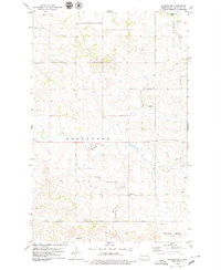
1978 Map of Schafer SE
USGS Topo · Published 1979About this map
Blue Butte and the rugged breaks of the Bear Den country dominate this McKenzie County landscape during the late 1970s. The map illustrates a remote prairie terrain transitioning into the badlands, where the North Fork of North Fork Creek carves through the central townships. The presence of Trinity Cem and scattered landmarks like the Flowing Well provide essential coordinates for genealogists and local historians tracing rural ties to this sparsely populated region.
Find a feature on this map
11 named features on this map. Tap any name to fly to it.
Don’t see what you’re looking for? This feature index may not catch every label — zoom into the map to look around manually.
Map Details
Editions of this 1978 Schafer SE Map
This is the sole edition of this map. No revisions or reprints were ever made.
Other maps of this area

1953 · Watford City
USGS Topo · 1:250,000

1957 · Watford City
USGS Topo · 1:250,000

1959 · Lone Butte NW
USGS Topo · 1:24,000

1959 · Croff
USGS Topo · 1:24,000

1959 · Lone Butte NE
USGS Topo · 1:24,000

1965 · Keene
USGS Topo · 1:24,000

1965 · Johnsons Corner
USGS Topo · 1:24,000

1967 · Watford City
USGS Topo · 1:250,000

1978 · Schafer
USGS Topo · 1:24,000
1982 · Parshall
USGS Topo · 1:100,000