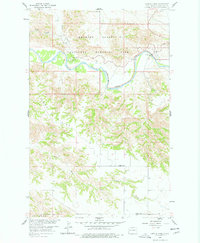
1958 Map of Long X Divide
USGS Topo · Published 1978About this map
Theodore Roosevelt National Memorial Park dominates the northern reaches of this mid-century landscape, where the Little Missouri River carves a winding path through the broken badlands terrain. The survey captures a sparsely populated region of McKenzie County defined by the prominent Long X Divide and the rugged drainage systems of Squaw Creek and Cedar Canyon.
Find a feature on this map
14 named features on this map. Tap any name to fly to it.
Don’t see what you’re looking for? This feature index may not catch every label — zoom into the map to look around manually.
Map Details
Editions of this 1958 Long X Divide Map
2 editions found
Other maps of this area

1953 · Watford City
USGS Topo · 1:250,000

1957 · Watford City
USGS Topo · 1:250,000

1958 · Long X Divide
USGS Topo · 1:24,000

1958 · Sperati Point
USGS Topo · 1:24,000

1958 · Lone Butte
USGS Topo · 1:24,000

1958 · Stocke Butte
USGS Topo · 1:24,000

1958 · Tepee Buttes
USGS Topo · 1:24,000

1959 · Lone Butte NW
USGS Topo · 1:24,000

1967 · Watford City
USGS Topo · 1:250,000

1974 · Wolf Coulee
USGS Topo · 1:24,000