
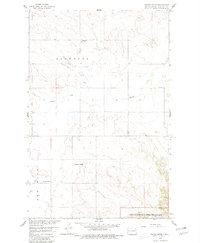
1958 Map of Stocke Butte
USGS Topo · Published 1960About this map
Ellsworth township and the surrounding Badlands landscape define this mid-century survey of western North Dakota. The map captures a rural social fabric focused around the Town Hall and the Zoar Ch and adjacent Cem, reflecting a period of settled agricultural life before later shifts in land use. Education for the dispersed population was centered at the Red Wing Sch, located near the Red Wing Creek drainage. The southern edge of the map introduces the distinct, eroded topography of the Theodore Roosevelt National Memorial Park, where the elevation rises significantly toward the Long X Divide. Prominent geographic features like Stocke Butte and the Tepee Buttes provided essential navigation points for ranchers and early residents navigating the drainage systems of Cherry Creek.
Find a feature on this map
15 named features on this map. Tap any name to fly to it.
Don’t see what you’re looking for? This feature index may not catch every label — zoom into the map to look around manually.
Map Details
Editions of this 1958 Stocke Butte Map
2 editions found
Other maps of this area

1953 · Watford City
USGS Topo · 1:250,000

1957 · Watford City
USGS Topo · 1:250,000

1958 · Long X Divide
USGS Topo · 1:24,000

1958 · Sperati Point
USGS Topo · 1:24,000

1958 · Tepee Buttes
USGS Topo · 1:24,000

1967 · Watford City
USGS Topo · 1:250,000

1972 · Bear Butte
USGS Topo · 1:24,000

1972 · Rawson
USGS Topo · 1:24,000

1978 · Arnegard
USGS Topo · 1:24,000
1978 · Watford City
USGS Topo · 1:24,000