1980s Maps of Grant County, North Dakota
Explore 25 historic maps of Grant County from the 1980s. These maps offer a rare glimpse into what life looked like during the 1980s — showing old roads, neighborhoods, homes, and landmarks that have changed or disappeared over time.
Whether you're researching your family's past, planning a metal detecting trip, or studying how Grant County's landscape evolved across the 1980s, these high-resolution maps are a powerful tool for exploring the history of this region.
- Focus on a specific era: All maps on this page are from the 1980s, giving you a focused view of this time period.
- See what’s changed: Compare century-old streets, trails, and buildings to today's modern landscape using overlays and satellite layers.
- Research with precision: Use these maps for genealogy, historical research, land use analysis, or educational projects.
- View, download, or print: Maps are fully viewable online in high resolution, and can be downloaded or printed for your own records.
Start exploring Grant County's history through authentic maps from the 1980s. This is your window into the past.
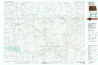
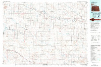
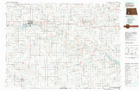
Grant County, ND maps
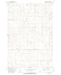
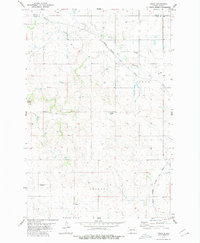
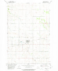
(25)- 1980 Map of Otter Creek West
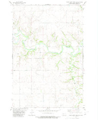
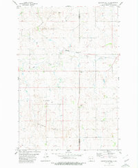
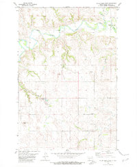 1980 Otter Creek West1980 Print · USGSGrant County is shown in the late seventies as a landscape of winding river valleys and prominent high points. Local historians can locate the Otter Creek Cemetery, trace the path of the Heart River, and find specific crossings like the Thompson Bridge.
 - 1980 Map of Green Ridge
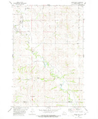
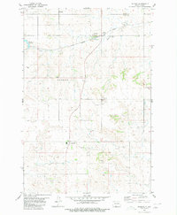
 1980 Green Ridge1980 Print · USGSMorton and Grant counties are captured here in the mid-seventies, showing a quiet landscape of prairie homesteads and creek-cut valleys. Genealogists can locate Bethel Ch and Zion Cem or trace rural community life at Big Heart Hall.
 - 1980 Map of Crown Butte Creek NW
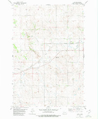
 1980 Crown Butte Creek NW1980 Print · USGSThe high plains of Morton and Grant counties are captured here in the mid-seventies, showing a landscape defined by ranching and resource extraction. Researchers can trace the path of Crown Butte Creek through the Ramsland Hills and locate remote infrastructure like the isolated Landing Strip.
 - 1980 Map of Lake Tschida East
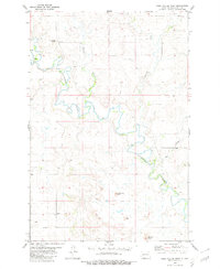
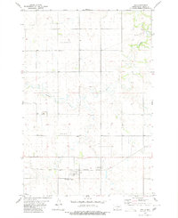
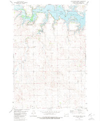
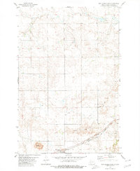
 1980 Lake Tschida East1980 Print · USGSLake Tschida and the Heart River valley are captured in the early eighties during a period of established recreation and water management. Genealogists and local historians can locate the Murphy settlement, a rural Cem, and the various Campgrounds lining the reservoir.
 - 1980 Map of Brisbane
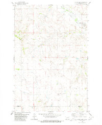
 1980 Brisbane1980 Print · USGSGrant County’s prairie landscape is captured here in the mid-1970s, showing the intersection of rail transit and rural agriculture. Genealogists and historians can trace the Chicago Milwaukee St Paul and Pacific line past Brisbane and the local Cem.
 - 1980 Map of Otter Creek East
 1980 Otter Creek East1980 Print · USGSGrant and Morton Counties are captured here in the late seventies, showing a landscape defined by the winding Heart River. Researchers can trace old drainage patterns and land use near the Otter Creek State Game Management Area and along Bridge Coulee.
 - 1980 Map of Bell Coulee West
 1980 Bell Coulee West1980 Print · USGSGrant County’s river valleys and high buttes are captured here during the 1980s, showcasing the winding Cannonball River. Trace local landmarks like Paradise Ch and the distinct summits of Rattlesnake Butte and Flat Top Butte.
 - 1980 Map of Crown Butte Creek SE
 1980 Crown Butte Creek SE1980 Print · USGSGrant County in the mid-seventies is defined by the sweeping bends of the Heart River and the high prairie landscape of the Missouri Plateau. Historians and researchers can trace vital water sources and landmarks like Schrock Dam, Crown Butte, and Pump Coulee.
 - 1980 Map of Freda
 1980 Freda1980 Print · USGSThe high plains of the North Dakota borderlands are captured here in the late seventies as a rail-dependent agricultural landscape. Trace the Milwaukee Road tracks through Freda or locate the Bethesda Cem and Three Buttes.
 - 1980 Map of Almont East
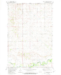
 1980 Almont East1980 Print · USGSThe town of Almont and the surrounding Morton County prairie are captured here in 1980. Researchers can trace the Old Railroad Grade and locate local landmarks like the Rodeo Ground, Almont Cem, and Antelope Butte.
 - 1980 Map of Lark
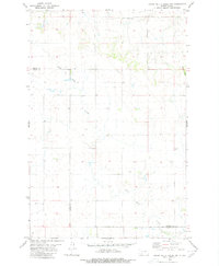
 1980 Lark1980 Print · USGSThe settlement of Lark sits at a mid-century crossroads of rail and water in Grant County. Local historians can trace the Burlington Northern line and identify historic landmarks like Pleasant View Cem and the winding Louse Creek.
 - 1980 Map of Heil
 1980 Heil1980 Print · USGSHeil and the surrounding Grant County prairie are captured here in the 1980s, centered on the Burlington Northern rail line. Genealogists and local historians can locate Prairie View Cem, Peace Cem, and the high ground of Elm Butte.
 - 1980 Map of Crown Butte Creek SW
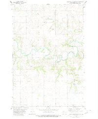
 1980 Crown Butte Creek SW1980 Print · USGSThe Heart River valley in Grant County during the 1980s reveals a landscape defined by its winding waterways and high plains. Genealogists and researchers can trace the natural boundaries of Heart River and its intersections with Antelope Creek and Crown Butte Cr.
 - 1980 Map of Bell Coulee East
 1980 Bell Coulee East1980 Print · USGSThe Cannonball River valley and the Standing Rock Indian Reservation are captured here in the mid-1970s. Trace the rural landscape through landmarks like St Gabriel Cem and a river Ford along the county line.
 - 1980 Map of Elgin
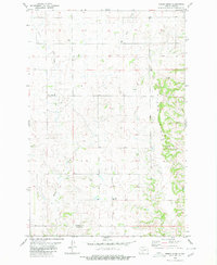
 1980 Elgin1980 Print · USGSGrant County is captured in the late seventies as a busy rail and agricultural crossroads centered on Elgin. Researchers can trace the dual paths of the Burlington Northern and Milwaukee Road through settlements like Leipzig and Kaiser.
 - 1980 Map of Lake Tschida West
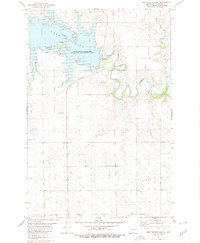
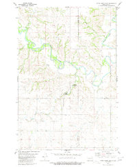
 1980 Lake Tschida West1980 Print · USGSGrant County’s landscape was transformed in the late twentieth century by the rising waters of the Heart Butte Reservoir. Genealogists and local historians can locate the Johannestal Cem, the rural Leipzig settlement, and Trinity Ch.
 - 1980 Map of Dogtooth Buttes
 1980 Dogtooth Buttes1980 Print · USGSGrant and Morton counties in the mid-1970s are defined by the prominent landforms of Dogtooth Buttes and the winding course of Louse Creek. Researchers can trace the path of the Burlington Northern railroad or locate unique landmarks like Deadman Cave.
 - 1980 Map of Raleigh
 1980 Raleigh1980 Print · USGSThe Grant and Morton County borderlands in the early 1980s centered on the rail-side community of Raleigh and the prairie settlement of St Gertrude. Researchers can trace the path of the Chicago Milwaukee St Paul and Pacific and locate local landmarks like the Rodeo Ground or Three Buttes.
 - 1980 Map of New Leipzig North
 1980 New Leipzig North1980 Print · USGSGrant County’s rolling prairie and coal-rich hills are shown here during the late twentieth century as the region balanced farming with industrial extraction. Genealogists and researchers can locate Ebenezer Ch, the Davenport Strip Mine, and the rail corridor at New Leipzig.
 - 1980 Map of Almont West
 1980 Almont West1980 Print · USGSNorth Dakota's rural heartland is documented here in the late seventies, showing the landscape around the Morton and Grant county line. Researchers can trace the layout of Almont and locate family landmarks like the Ramsland Hills or scattered Well sites.
 - 1980 Map of Elgin
 1980 Elgin1980 Print · USGSNorth Dakota's southern plains come alive in the early eighties as the Standing Rock Indian Reservation meets the Cannonball River. Trace the rail lines serving Elgin and Carson, or locate family-named landmarks like Thompson Butte and Heil.
 - 1980 Map of Carson
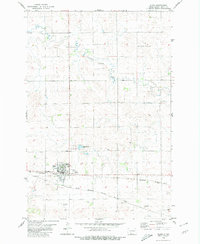
 1980 Carson1980 Print · USGSCarson was a vital rail and community hub in Grant County during the late seventies. Researchers can trace local heritage at Emmaus Cem and the Community Cem, or explore the terrain around Cookout Butte and the Rodeo Ground.
 - 1980 Map of Glen Ullin
 1980 Glen Ullin1980 Print · USGSMorton County in the late seventies is captured here, centered on the railroad towns of Glen Ullin and New Salem. Local historians can trace early settlements like Bluegrass and Almont or the growth of the Heart Butte Reservoir and regional Strip Mine operations.
 - 1980 Map of Mott, 1981 Print
 1980 Mott1981 Print · USGSThe North Dakota plains around the turn of the 1980s reveal a landscape of river-valley farming and critical rail connections. Researchers can trace the path of the Milwaukee Road through Bucyrus or locate landmarks like East Rainy Butte and Tepee Buttes.
 - 1981 Map of Dickinson
 1981 Dickinson1981 Print · USGSSouthwestern North Dakota prairie and the growing hub of Dickinson are captured here in the early eighties. Genealogists and local historians can trace the rail-side growth of Hebron and Gladstone or locate rural landmarks like New Hradec and Custer Lookout.
End of results
Showing maps 1-25 of 25
Top cities of Grant County
- Elgin historical maps
- Carson historical maps
- New Leipzig historical maps
- Raleigh historical maps
- Lark historical maps
- Leith historical maps
See more
Frequently asked questions
- What are the different types of historical maps available for Grant County?
- What is the oldest map of Grant County?
- Where can I purchase historical maps of Grant County for my home or office?
- Where can I download high-res historical maps of Grant County?
- Are there historical topographic maps available for Grant County?
- Is there historical aerial imagery available for Grant County?
- Where are historical maps of Grant County sourced from?