1900s (20th Century) Maps of Grant County, North Dakota
Explore 59 historic maps of Grant County from the 1900s (20th Century). These maps offer a rare glimpse into what life looked like during the 1900s — showing old roads, neighborhoods, homes, and landmarks that have changed or disappeared over time.
Whether you're researching your family's past, planning a metal detecting trip, or studying how Grant County's landscape evolved across the 1900s, these high-resolution maps are a powerful tool for exploring the history of this region.
- Focus on a specific era: All maps on this page are from the 1900s, giving you a focused view of this time period.
- See what’s changed: Compare century-old streets, trails, and buildings to today's modern landscape using overlays and satellite layers.
- Research with precision: Use these maps for genealogy, historical research, land use analysis, or educational projects.
- View, download, or print: Maps are fully viewable online in high resolution, and can be downloaded or printed for your own records.
Start exploring Grant County's history through authentic maps from the 1900s. This is your window into the past.
Grant County, ND maps
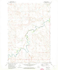
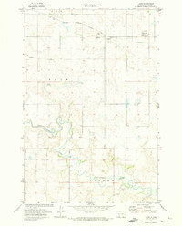
(59)- 1938 Map of Heart Butte
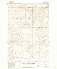
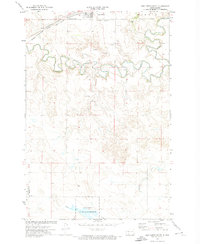
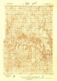 1938 Heart Butte1938 Print · USGSAcross Morton and Grant counties in the late 1930s, this survey captures the rural landscape before the creation of the reservoir. Genealogists can trace early landmarks like Johannestown Ch, the Lignite Mine, and Johnson Ford.
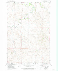
 - 1944 Map of Heart Butte
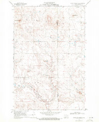
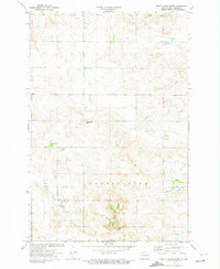
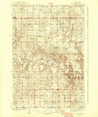 1944 Heart Butte1944 Print · USGSThe rural expanses of Grant and Morton Counties are shown here just before the mid-century, defined by a network of one-room schoolhouses and remote farmsteads. Researchers can trace early family ties at St Joseph Ch or locate the local Lignite Mine along the Heart River.
 - 1953 Map of Dickinson, 1968 Print
 1953 Dickinson1968 Print · USGSWestern North Dakota in the fifties remains a landscape of rail-linked prairie towns and rugged badlands. Trace the local impact of the Northern Pacific railroad through Dickinson or locate early rural landmarks like Rainy Butte Church and Boys Ranch.2 unique versions available
 - 1954 Map of Bismarck, 1967 Print
 1954 Bismarck1967 Print · USGSBismarck and the Missouri River basin are shown in the mid-1960s as the Oahe Reservoir reshaped the valley. Genealogists can trace family-named landmarks like Dog Tooth Buttes and small prairie settlements such as Fort Yates, Selfridge, and Brisbane.2 unique versions available
 - 1957 Map of Dickinson
 1957 Dickinson1957 Print · USGSSouthwestern North Dakota in the mid-fifties is a landscape of coal mining and tight-knit rural school districts. Genealogists can trace family footprints through numerous country schools like Fisher School and parish churches like St Stephens.
 - 1958 Map of Bismarck
 1958 Bismarck1958 Print · USGSCentral North Dakota in the late fifties is defined by the Missouri River and the sprawling Standing Rock Indian Reservation. Genealogists and historians can trace rail-line outposts like Sedalia Siding or explore local landmarks like Saint Anthony and Fort Lincoln State Park/Museum.
 - 1960 Map of Heart Butte NW, 1962 Print
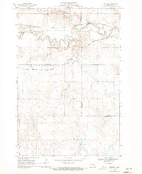
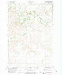
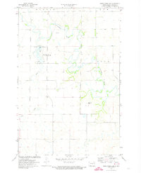
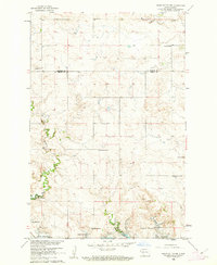 1960 Heart Butte NW1962 Print · USGSThe prairie of Morton and Grant counties is shown in the early 1960s as the Missouri River Basin development reshaped the landscape. Genealogy researchers can trace rural school districts like Heart Butte Sch No 5 and local burials at Koehler Cem.
 - 1960 Map of Clark Butte NE, 1962 Print
 1960 Clark Butte NE1962 Print · USGSThe North Dakota prairie near the intersection of Grant, Morton, and Stark counties is captured here in the early sixties. Researchers can find rural landmarks such as SS Peter and Paul Ch, Heart Butte School No 2, and the newly formed Lake Tschida.
 - 1960 Map of Heart Butte, 1962 Print
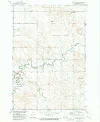
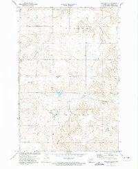
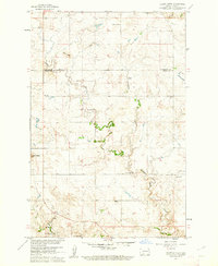 1960 Heart Butte1962 Print · USGSThe Grant County plains in the early sixties show a transition from traditional prairie life to the era of large-scale water projects. Trace the location of many rural schoolhouses like Hertz Sch No 2 and the historic Old St Joseph Cem.
 - 1960 Map of Clark Butte, 1962 Print
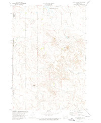
 1960 Clark Butte1962 Print · USGSHettinger and Grant Counties appear at the start of the 1960s, showing a landscape of rural townships and prairie schools. Genealogists can locate family landmarks like Zion Cem and Salem Ch or trace the early paths near Clark Butte.
 - 1969 Map of North Star Butte, 1971 Print
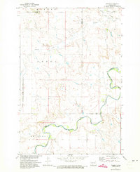
 1969 North Star Butte1971 Print · USGSThe high plains along the Hettinger and Grant county line are captured here in the late sixties. Genealogists and historians can trace rural burial sites at Philadelphia Cem and Ebenezer Cem or locate industrial activity at the Strip Mines.
 - 1969 Map of Bentley, 1971 Print
 1969 Bentley1971 Print · USGSThe Hettinger and Grant County line comes alive in the late sixties as the railroads cross the plains. Genealogists and historians can trace the Burlington Northern line, find the Odessa Cem, and locate the settlement of Bentley.
 - 1971 Map of Lookout Butte, 1973 Print
 1971 Lookout Butte1973 Print · USGSThe North Dakota prairie along the Standing Rock reservation border comes into focus in the early 1970s. Trace local history through landmarks like Communion Cemetery, Lookout Butte, and the winding path of Cedar Creek.
 - 1971 Map of Shields, 1973 Print
 1971 Shields1973 Print · USGSThe border between Grant and Sioux counties follows the winding path of the Cannonball River in the early 1970s. Local researchers can trace the rail corridor of the C M St P & P and locate specific sites like the community of Shields and various Gravel Pits.
 - 1971 Map of Lookout Butte SE, 1973 Print
 1971 Lookout Butte SE1973 Print · USGSThe Sioux and Grant County borderlands in the early 1970s are defined by the winding waters of the Cannonball River and the Standing Rock Reservation line. Researchers can trace land boundaries and natural water sources like Cedar Creek, Leaf on the Hill Creek, and a local Gravel Pit.
 - 1971 Map of Porcupine, 1973 Print
 1971 Porcupine1973 Print · USGSSioux County's rail and reservation land are captured here in the early seventies, centered on the Standing Rock Indian Reservation. Genealogists and historians can trace the tracks of the Chicago Milwaukee St Paul and Pacific through the settlements of Shields, Porcupine, and Chadwick.
 - 1971 Map of Timmer, 1973 Print
 1971 Timmer1973 Print · USGSThe prairie landscape of south-central North Dakota is captured here in the early 1970s, as the Cannonball River winds along the Standing Rock Indian Reservation Boundary. Researchers can locate the community of Timmer and its local landmarks, including St George Ch and the old Chicago Milwaukee St Paul and Pacific Railroad Grade.
 - 1972 Map of Carson SE, 1974 Print
 1972 Carson SE1974 Print · USGSThe high plains of Grant County are captured in the early 1970s, showing a landscape shaped by rail and river. Researchers can trace the Chicago Milwaukee St Paul and Pacific through Brisbane or locate the St Vincent Cem near the winding Boxelder Creek.
 - 1972 Map of Leith, 1974 Print
 1972 Leith1974 Print · USGSLeith and the surrounding Grant County prairie are captured in the early 1970s, showing a landscape defined by the Cannonball River and local industry. Genealogists and historians can trace the Chicago Milwaukee St Paul and Pacific railroad line and locate old mining sites like Binek Mine and Lahr Mine.
 - 1972 Map of Paradise Flats, 1974 Print
 1972 Paradise Flats1974 Print · USGSGrant County is captured in the early 1970s as the Cannonball River snakes through a deeply carved landscape. Local researchers can trace the elevation changes from Paradise Flats down to Boxelder Creek and locate early sites like Schultz.
 - 1972 Map of Wheeler Hills, 1974 Print
 1972 Wheeler Hills1974 Print · USGSIn the early 1970s, this area of Grant County was defined by its rolling ranchlands and high points like Russell Butte. Genealogists and local historians can trace rural landmarks including St Marys Ch, Bethesda Ch, and several family-named rises.
 - 1972 Map of Coffin Buttes, 1974 Print
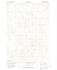
 1972 Coffin Buttes1974 Print · USGSGrant County at the start of the 1970s reveals a prairie landscape of isolated lookouts and early conservation efforts. Researchers can locate the Selma Union Cem and trace the contours of Coffin Buttes and the Pretty Rock National Wildlife Refuge.
 - 1972 Map of New Leipzig South, 1974 Print
 1972 New Leipzig South1974 Print · USGSThe rural landscape south of New Leipzig in the 1970s shows a transition between traditional agriculture and early industrial mining activity. Genealogists can locate several distinct burial sites including Congregation Cem, Finnish Cem, and Fleak Cem near the Cannonball River.
 - 1972 Map of Pretty Rock Butte, 1974 Print
 1972 Pretty Rock Butte1974 Print · USGSGrant County ranchlands are documented here in the early seventies, showing a wide-open prairie landscape shaped by its distinct buttes and creeks. Genealogists and local historians can locate the Pretty Rock Cem, the local Townhall, and landmarks like Beer Bum Hill.
 - 1972 Map of Sheep Creek Dam, 1974 Print
 1972 Sheep Creek Dam1974 Print · USGSThe Grant County prairie comes into focus during the early 1970s, showcasing a landscape defined by the winding Cannonball River. You can trace the development of the Sheep Creek Dam and find local landmarks like Medicine Rock.
Showing maps 1-25 of 59
Top cities of Grant County
- Elgin historical maps
- Carson historical maps
- New Leipzig historical maps
- Raleigh historical maps
- Lark historical maps
- Leith historical maps
See more
Frequently asked questions
- What are the different types of historical maps available for Grant County?
- What is the oldest map of Grant County?
- Where can I purchase historical maps of Grant County for my home or office?
- Where can I download high-res historical maps of Grant County?
- Are there historical topographic maps available for Grant County?
- Is there historical aerial imagery available for Grant County?
- Where are historical maps of Grant County sourced from?