
1971 Map of Lookout Butte
USGS Topo · Published 1973About this map
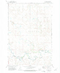
Cedar Creek meanders deeply across the prairie of the Standing Rock Indian Reservation, defining the border between Grant and Sioux counties. This landscape, surveyed in the early 1970s, is characterized by prominent high points including Lookout Butte, Cedar Butte, and Smokey Butte that rise above the drainage systems of Plum Creek and Timber Creek. The sparse settlement patterns of this era are evident in the isolated Communion Cemetery and scattered Well sites across the township grids. These small, localized landmarks, alongside a solitary Grave and small Gravel Pit operations, provide important touchstones for understanding the rural infrastructure and genealogy of the Cannonball river basin before more modern developments altered the region.
Find a feature on this map
15 named features on this map. Tap any name to fly to it.
Don’t see what you’re looking for? This feature index may not catch every label — zoom into the map to look around manually.
Map Details
Editions of this 1971 Lookout Butte Map
This is the sole edition of this map. No revisions or reprints were ever made.
Other maps of this area

1953 · McIntosh
USGS Topo · 1:250,000

1954 · Bismarck
USGS Topo · 1:250,000

1958 · Bismarck
USGS Topo · 1:250,000

1958 · McIntosh
USGS Topo · 1:250,000

1971 · Lookout Butte SE
USGS Topo · 1:24,000

1972 · Paradise Flats
USGS Topo · 1:24,000

1972 · Watauga
USGS Topo · 1:24,000

1972 · Hump Butte
USGS Topo · 1:24,000

1972 · McIntosh
USGS Topo · 1:24,000
1972 · Pitt Creek
USGS Topo · 1:24,000