
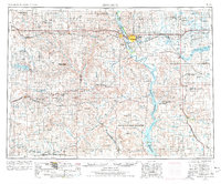
1954 Map of Bismarck
USGS Topo · Published 1967About this map
Standing Rock Indian Reservation dominates the southern landscape of this mid-century survey, where the Missouri River transforms into the expansive Oahe Reservoir. The state capital of Bismarck and neighboring Mandan serve as the central hub for the region's transportation network, including the Northern Pacific railroad and major roadways revised here through 1966. The geography is defined by a series of distinct landmarks such as Dog Tooth Buttes and Heart Butte, alongside the waters of Lake Tschida. This era reflects a transition in land use, balancing the established agriculture of settlements like Fort Yates and Selfridge with the conservation efforts seen in several protected areas, including the Long Lake National Wildlife Refuge and Pretty Rock National Wildlife Refuge. Cultural history is noted at the Fort Lincoln State Park Museum, marking the long-standing significance of this river crossing.
Find a feature on this map
95 named features on this map. Tap any name to fly to it.
Don’t see what you’re looking for? This feature index may not catch every label — zoom into the map to look around manually.
Map Details
Editions of this 1954 Bismarck Map
2 editions found
Other maps of this area

1907 · Bismarck
USGS Topo · 1:125,000

1938 · Heart Butte
USGS Topo · 1:48,000

1944 · Heart Butte
USGS Topo · 1:62,500

1950 · Wilton
USGS Topo · 1:62,500

1950 · Bismarck
USGS Topo · 1:24,000

1951 · Menoken SW
USGS Topo · 1:24,000

1951 · Bismarck
USGS Topo · 1:62,500

1951 · Mandan
USGS Topo · 1:24,000

1951 · Menoken
USGS Topo · 1:62,500

1951 · McKenzie
USGS Topo · 1:62,500