
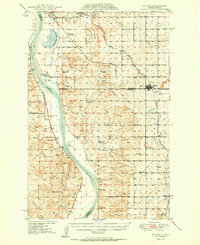
1950 Map of Wilton
USGS Topo · Published 1950About this map
The Missouri River corridor north of Bismarck is captured here during a period of transition, where the river's winding course forms the boundary between Oliver, McLean, and Burleigh counties. The landscape is a mix of river bottomlands and high plains, punctuated by significant landmarks like the Molander Indian Village Historic Site and the prominent Square Buttes. Rail lines define the local economy, with the Northern Pacific following the western riverbank and the Minneapolis St Paul and Sault Ste Marie serving the upland prairie.
Find a feature on this map
43 named features on this map. Tap any name to fly to it.
Don’t see what you’re looking for? This feature index may not catch every label — zoom into the map to look around manually.
Map Details
Editions of this 1950 Wilton Map
2 editions found
Other maps of this area

1907 · Bismarck
USGS Topo · 1:125,000

1949 · Turtle Creek
USGS Topo · 1:62,500

1949 · Washburn
USGS Topo · 1:62,500

1951 · Bismarck
USGS Topo · 1:62,500

1951 · Menoken
USGS Topo · 1:62,500

1954 · Bismarck
USGS Topo · 1:250,000

1954 · McClusky
USGS Topo · 1:250,000

1958 · Bismarck
USGS Topo · 1:250,000

1958 · McClusky
USGS Topo · 1:250,000

1959 · Mercer SW
USGS Topo · 1:24,000