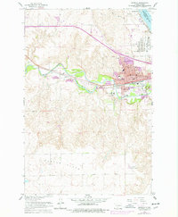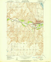
1951 Map of Mandan
USGS Topo · Published 1951About this map
The confluence of the Missouri River and Heart River dictates the landscape of this 1951 survey, where the bustling city of Mandan serves as a vital rail and civic hub. The Northern Pacific railroad tracks bisect the region, passing through the small community of Sunny and following the river valley's natural contours. Cultural development is concentrated in the east, featuring a dense network of local institutions including St Joseph Sch, Central Sch, and the State Training School. To the west, the topography rises into the open stretches of Custer Flats, while the Great Plains Experiment Station occupies a significant tract south of the city. The map also captures the intricate drainage patterns of Dead Heart Slough and Hay Creek, providing a detailed view of the Missouri River's floodplain before modern development altered these historic waterways.
Find a feature on this map
32 named features on this map. Tap any name to fly to it.
Don’t see what you’re looking for? This feature index may not catch every label — zoom into the map to look around manually.
Map Details
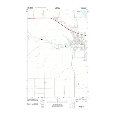
Editions of this 1951 Mandan Map
This is the sole edition of this map. No revisions or reprints were ever made.
Historical Maps of Mandan Through Time
7 maps found