
1962 Map of Schmidt
USGS Topo · Published 1963About this map
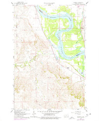
The Missouri River corridor south of Bismarck is defined here by the emerging waters of the Oahe Reservoir, which began flooding the valley floor in the years following the completion of the Oahe Dam. This 1962 field-checked survey captures the landscape as it transitions from a traditional riverine environment to a regulated reservoir system. Along the western bank, the Northern Pacific railroad tracks hug the base of the bluffs, passing through the small settlement of Schmidt. The map provides significant historical context by marking the boundaries of the Old Fort Lincoln Military Reservation and the Old Fort Rice Military Reservation, reflecting the region's 19th-century frontier history. Educational and religious life is noted by the presence of Bonanza Sch No 4, the Fort Lincoln Sch, and the Annunciation Priory overlooking Apple Creek. Significant tributaries like the Little Heart River are shown winding through the dissected terrain of Morton County.
Find a feature on this map
13 named features on this map. Tap any name to fly to it.
Don’t see what you’re looking for? This feature index may not catch every label — zoom into the map to look around manually.
Map Details
Editions of this 1962 Schmidt Map
2 editions found
Other maps of this area

1907 · Bismarck
USGS Topo · 1:125,000

1950 · Bismarck
USGS Topo · 1:24,000

1951 · Menoken SW
USGS Topo · 1:24,000

1951 · Bismarck
USGS Topo · 1:62,500

1951 · Mandan
USGS Topo · 1:24,000

1951 · Menoken
USGS Topo · 1:62,500

1954 · Bismarck
USGS Topo · 1:250,000

1958 · Bismarck
USGS Topo · 1:250,000

1962 · Sugarloaf Butte
USGS Topo · 1:24,000

1962 · Menoken SW
USGS Topo · 1:24,000