
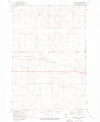
1971 Map of Lookout Butte SE
USGS Topo · Published 1973About this map
The Standing Rock Indian Reservation Boundary cuts through the northern portion of this landscape, defining the jurisdictional edge between Grant and Sioux counties. The terrain is deeply influenced by the convergence of the Cannonball R and Cedar Creek, which meander through the prairie with complex riparian bends. These waterways are joined by smaller drainages including Leaf on the Hill Creek and Roger Creek, illustrating a classic Great Plains hydrology.
Find a feature on this map
10 named features on this map. Tap any name to fly to it.
Don’t see what you’re looking for? This feature index may not catch every label — zoom into the map to look around manually.
Map Details
Editions of this 1971 Lookout Butte SE Map
This is the sole edition of this map. No revisions or reprints were ever made.
Other maps of this area

1953 · McIntosh
USGS Topo · 1:250,000

1954 · Bismarck
USGS Topo · 1:250,000

1958 · Bismarck
USGS Topo · 1:250,000

1958 · McIntosh
USGS Topo · 1:250,000

1971 · Lookout Butte
USGS Topo · 1:24,000

1971 · Shields SW
USGS Topo · 1:24,000

1971 · Shields
USGS Topo · 1:24,000

1972 · Hump Butte
USGS Topo · 1:24,000

1972 · McIntosh
USGS Topo · 1:24,000
1972 · Tatanka Lake
USGS Topo · 1:24,000