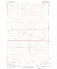
1972 Map of Tatanka Lake
USGS Topo · Published 1975About this map
Tatanka Lake and the surrounding prairie of the Standing Rock Indian Reservation are documented here in the early 1970s, straddling the border of North Dakota and South Dakota. The landscape is defined by the drainage of Leaf on the Hill Creek and the prominent rise of Leaf-on Hill. A significant industrial corridor is formed by the Chicago Milwaukee St Paul and Pacific railroad, which cuts through the center of the sheet near the state line. The survey captures a sparsely populated region divided between Lake and Walker townships, where several water wells are the primary indicators of localized activity. This topographic study provides a clear view of the high plains terrain and the vital rail infrastructure that connected these borderlands before the late 20th century.
Find a feature on this map
10 named features on this map. Tap any name to fly to it.
Don’t see what you’re looking for? This feature index may not catch every label — zoom into the map to look around manually.
Map Details
Editions of this 1972 Tatanka Lake Map
This is the sole edition of this map. No revisions or reprints were ever made.
Other maps of this area

1953 · McIntosh
USGS Topo · 1:250,000

1954 · Bismarck
USGS Topo · 1:250,000

1956 · Bullhead
USGS Topo · 1:24,000

1956 · Bullhead SW
USGS Topo · 1:24,000

1958 · Bismarck
USGS Topo · 1:250,000

1958 · McIntosh
USGS Topo · 1:250,000

1971 · Shields SW
USGS Topo · 1:24,000

1971 · Lookout Butte SE
USGS Topo · 1:24,000

1971 · Pamplin Hills
USGS Topo · 1:24,000

1972 · Walker
USGS Topo · 1:24,000