
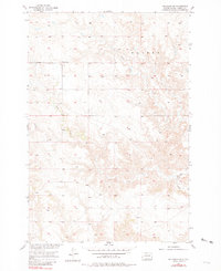
1956 Map of Bullhead SW
USGS Topo · Published 1957About this map
The rolling plains of Corson County are defined here by a network of drainage systems and early prairie boundaries in the mid-1950s. The landscape is split between the townships of Grant and Walker, where the topography is shaped by the winding courses of Iron Dog Creek and Stink Creek. This period in South Dakota's history shows a sparsely populated region primarily characterized by its geography rather than dense development. A key institutional marker for local families is the Grant Sch, a rural schoolhouse situated amidst the high-ground benches. To the south, the benchmark at Bullhead 2097 provides a high point in the terrain, reflecting the detailed elevation mapping conducted as part of the Department of the Interior's Missouri River Basin development program.
Find a feature on this map
6 named features on this map. Tap any name to fly to it.
Don’t see what you’re looking for? This feature index may not catch every label — zoom into the map to look around manually.
Map Details
Editions of this 1956 Bullhead SW Map
2 editions found
Other maps of this area

1953 · McIntosh
USGS Topo · 1:250,000

1956 · Black Horse NE
USGS Topo · 1:24,000

1956 · Bullhead
USGS Topo · 1:24,000

1956 · Miscol
USGS Topo · 1:24,000

1956 · Miscol NE
USGS Topo · 1:24,000

1958 · McIntosh
USGS Topo · 1:250,000

1972 · Walker
USGS Topo · 1:24,000
1972 · McIntosh SE
USGS Topo · 1:24,000

1972 · McIntosh
USGS Topo · 1:24,000
1972 · Tatanka Lake
USGS Topo · 1:24,000