
1956 Map of Bullhead
USGS Topo · Published 1957About this map
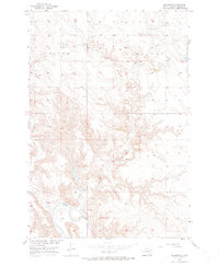
Bullhead stands near the southern banks of the Grand River in Corson County, established here on the Standing Rock Reservation. This 1950s survey documents a landscape defined by sharp topographical relief as the high prairie breaks down into the river valley. The settlement pattern is sparse, concentrated primarily around the river bend where the water serves as a vital geographic anchor. Major drainage systems including Rock Creek, Stink Creek, and Dog Creek carve through the surrounding terrain, illustrating the intricate watershed of the Missouri River Basin. Published as part of a Department of the Interior program for basin development, this map provides a precise record of rural South Dakota before more modern infrastructure changes, tracing the relationship between small-scale habitation and the expansive river network.
Find a feature on this map
5 named features on this map. Tap any name to fly to it.
Don’t see what you’re looking for? This feature index may not catch every label — zoom into the map to look around manually.
Map Details
Editions of this 1956 Bullhead Map
3 editions found
Other maps of this area

1953 · McIntosh
USGS Topo · 1:250,000

1956 · Little Eagle NW
USGS Topo · 1:24,000

1956 · Miscol
USGS Topo · 1:24,000

1956 · Bullhead SW
USGS Topo · 1:24,000

1956 · Miscol NE
USGS Topo · 1:24,000

1958 · McIntosh
USGS Topo · 1:250,000

1971 · McLaughlin SW
USGS Topo · 1:24,000
1971 · Maple Leaf
USGS Topo · 1:24,000

1972 · Walker
USGS Topo · 1:24,000
1972 · Tatanka Lake
USGS Topo · 1:24,000