
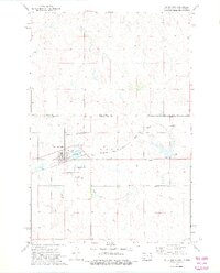
1972 Map of McIntosh
USGS Topo · Published 1975About this map
The town of McIntosh serves as a central hub on the Standing Rock Indian Reservation in this early 1970s survey, straddling the border between North Dakota and South Dakota. The landscape is defined by its transit connections, notably the Chicago Milwaukee St Paul and Pacific railroad line that cuts through the territory alongside the McIntosh Municipal Airport. These infrastructure markers reflect the mid-century logistics of the northern plains, where rail and regional air travel supported the surrounding agricultural and ranching communities.
Find a feature on this map
17 named features on this map. Tap any name to fly to it.
Don’t see what you’re looking for? This feature index may not catch every label — zoom into the map to look around manually.
Map Details
Editions of this 1972 McIntosh Map
2 editions found
Other maps of this area

1953 · McIntosh
USGS Topo · 1:250,000

1954 · Bismarck
USGS Topo · 1:250,000

1956 · Bullhead SW
USGS Topo · 1:24,000

1958 · Bismarck
USGS Topo · 1:250,000

1958 · McIntosh
USGS Topo · 1:250,000

1971 · Lookout Butte
USGS Topo · 1:24,000

1971 · Shields SW
USGS Topo · 1:24,000

1971 · Lookout Butte SE
USGS Topo · 1:24,000

1972 · McIntosh SW
USGS Topo · 1:24,000

1972 · Hump Butte
USGS Topo · 1:24,000
Featured Places
- McIntosh, Rock Creek District
- Porcupine District, ND
- Rock Creek District, SD
- Sioux County, ND
- Corson County, SD