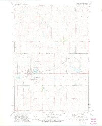
1972 Map of McIntosh
USGS Topo · Published 1975About this map
Mc Intosh serves as a key rail and agricultural hub along the Chicago Milwaukee St Paul and Pacific line in the early 1970s. This survey, conducted within the Standing Rock Indian Reservation, highlights the community infrastructure of the era, including the Mc Intosh Municipal Airport and a prominent Substation. The town is bounded by significant landmarks such as McIntosh Lake and the St Bonaventure Cem, providing a detailed look at the local geography near the North Dakota border.
Find a feature on this map
18 named features on this map. Tap any name to fly to it.
Don’t see what you’re looking for? This feature index may not catch every label — zoom into the map to look around manually.
Map Details
Editions of this 1972 McIntosh Map
2 editions found

Other maps of this area

1953 · McIntosh
USGS Topo · 1:250,000

1954 · Bismarck
USGS Topo · 1:250,000

1956 · Bullhead SW
USGS Topo · 1:24,000

1958 · Bismarck
USGS Topo · 1:250,000

1958 · McIntosh
USGS Topo · 1:250,000

1971 · Lookout Butte
USGS Topo · 1:24,000

1971 · Shields SW
USGS Topo · 1:24,000

1971 · Lookout Butte SE
USGS Topo · 1:24,000

1972 · McIntosh SW
USGS Topo · 1:24,000

1972 · Hump Butte
USGS Topo · 1:24,000
Featured Places
- McIntosh, Rock Creek District
- Rock Creek District, SD
- Porcupine District, ND
- Corson County, SD
- Sioux County, ND