
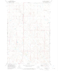
1972 Map of McIntosh SW
USGS Topo · Published 1975About this map
Prairie View dominates the northwestern section of this landscape, situated within the Standing Rock Indian Reservation during the early 1970s. The terrain is defined by the drainage patterns of Hump Creek and Little Soldier Creek, which carve through the high plains. Small-scale resource extraction is evident by the presence of a mine and several scattered wells, indicating a sparse human footprint centered on livestock grazing and occasional mineral interest. This survey reflects the quiet character of rural Corson County, where unimproved roads and section lines provide the primary framework for navigation across the open prairie.
Find a feature on this map
5 named features on this map. Tap any name to fly to it.
Don’t see what you’re looking for? This feature index may not catch every label — zoom into the map to look around manually.
Map Details
Editions of this 1972 McIntosh SW Map
This is the sole edition of this map. No revisions or reprints were ever made.
Other maps of this area

1953 · McIntosh
USGS Topo · 1:250,000

1956 · Black Horse NE
USGS Topo · 1:24,000

1956 · Cottonwood Creek NE
USGS Topo · 1:24,000

1956 · Black Horse
USGS Topo · 1:24,000

1958 · McIntosh
USGS Topo · 1:250,000

1972 · Morristown SE
USGS Topo · 1:24,000

1972 · Watauga
USGS Topo · 1:24,000

1972 · Hump Butte
USGS Topo · 1:24,000
1972 · McIntosh SE
USGS Topo · 1:24,000

1972 · McIntosh
USGS Topo · 1:24,000