
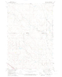
1971 Map of Pamplin Hills
USGS Topo · Published 1974About this map
The Pamplin Hills stretch across this region of the Standing Rock Indian Reservation in Sioux County, North Dakota. This 1971 survey illustrates a land largely defined by its natural topography rather than dense urban development, showing the complex drainage patterns and elevation changes across the Pamplin upland. The map documents the Missouri River Basin’s development through its detailed rendering of the township and range system, specifically marking T. 131 N., T. 130 N., and T. 129 N.. Researchers will find a landscape marked by scattered seasonal ponds and a network of unimproved roads that navigate the varying terrain of the reservation during the early 1970s.
Find a feature on this map
6 named features on this map. Tap any name to fly to it.
Don’t see what you’re looking for? This feature index may not catch every label — zoom into the map to look around manually.
Map Details
Editions of this 1971 Pamplin Hills Map
This is the sole edition of this map. No revisions or reprints were ever made.
Other maps of this area

1953 · McIntosh
USGS Topo · 1:250,000

1954 · Bismarck
USGS Topo · 1:250,000

1958 · Bismarck
USGS Topo · 1:250,000

1958 · McIntosh
USGS Topo · 1:250,000

1971 · Shields SW
USGS Topo · 1:24,000

1971 · Froelich Dam
USGS Topo · 1:24,000

1971 · Shields
USGS Topo · 1:24,000

1971 · Porcupine
USGS Topo · 1:24,000

1971 · Selfridge
USGS Topo · 1:24,000
1971 · Maple Leaf
USGS Topo · 1:24,000