
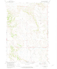
1971 Map of Selfridge
USGS Topo · Published 1974About this map
Selfridge sits as the central settlement on this Sioux County landscape, documented during a 1971 field check for the Missouri River Basin development program. The town’s layout is defined by the diagonal transit of the Chicago Milwaukee St Paul and Pacific railroad, which cuts through the prairie toward the northwest. Notable local landmarks include the Water Tank and the nearby Sewage Disposal Ponds south of the main townsite. To the south, St Philomena Cem provides a specific point of interest for genealogical research within the Standing Rock Indian Reservation. The northern portion of the map is dominated by the Porcupine Hills, where the drainage of Porcupine Creek carves through the terrain. This survey provides a clear view of the rural infrastructure and land management patterns in south-central North Dakota during the early 1970s.
Find a feature on this map
10 named features on this map. Tap any name to fly to it.
Don’t see what you’re looking for? This feature index may not catch every label — zoom into the map to look around manually.
Map Details
Editions of this 1971 Selfridge Map
This is the sole edition of this map. No revisions or reprints were ever made.
Other maps of this area

1953 · McIntosh
USGS Topo · 1:250,000

1954 · Bismarck
USGS Topo · 1:250,000

1958 · Bismarck
USGS Topo · 1:250,000

1958 · McIntosh
USGS Topo · 1:250,000

1966 · McLaughlin NE
USGS Topo · 1:24,000

1971 · Barren Butte
USGS Topo · 1:24,000

1971 · Froelich Dam
USGS Topo · 1:24,000

1971 · Porcupine
USGS Topo · 1:24,000
1971 · Selfridge SE
USGS Topo · 1:24,000

1971 · Pamplin Hills
USGS Topo · 1:24,000
Featured Places
- Fort Yates District, ND
- Selfridge, Porcupine District
- Porcupine District, ND
- Sioux County, ND
- United States