
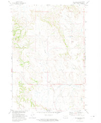
1971 Map of Barren Butte
USGS Topo · Published 1973About this map
Barren Butte rises as a prominent landmark in this segment of the Sioux County landscape, situated within the Standing Rock Indian Reservation. This 1971 field-checked survey reveals a topography defined by the drainage network of Porcupine Creek, which meanders through the northern and eastern portions of the quadrangle. Produced as part of the Department of the Interior's Missouri River Basin development program, the map documents a sparse, open territory primarily used for grazing and traditional land use. The absence of concentrated settlements highlights the enduring rural character of this region south of the Cannonball River, where the relief of the butte serves as one of the few significant geographical markers in an otherwise undulating terrain of the northern Great Plains.
Find a feature on this map
2 named features on this map. Tap any name to fly to it.
Don’t see what you’re looking for? This feature index may not catch every label — zoom into the map to look around manually.
Map Details
Editions of this 1971 Barren Butte Map
This is the sole edition of this map. No revisions or reprints were ever made.
Other maps of this area

1954 · Bismarck
USGS Topo · 1:250,000

1958 · Bismarck
USGS Topo · 1:250,000

1968 · Fort Yates NW
USGS Topo · 1:24,000

1968 · Fort Yates
USGS Topo · 1:24,000

1968 · Cannon Ball SW
USGS Topo · 1:24,000

1971 · Half Timber Butte
USGS Topo · 1:24,000

1971 · Froelich Dam
USGS Topo · 1:24,000

1971 · Solen SW
USGS Topo · 1:24,000
1971 · Selfridge SE
USGS Topo · 1:24,000

1971 · Selfridge
USGS Topo · 1:24,000