
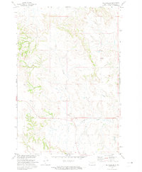
1968 Map of Fort Yates NW
USGS Topo · Published 1971About this map
Lake Oahe dominates the eastern landscape of this 1968 survey, its waters reaching into the winding valleys of Battle Creek and Porcupine Creek. This Missouri River Basin development era map captures the area shortly after the reservoir's creation, illustrating the inundation of the lower creek beds near the Standing Rock Ind Res Bdy. The terrain is characterized by the intricate drainage systems of Stone Man Creek and its namesake Stone Man Dam. Cultural markers are sparse in this rural expanse, though St Lukes Cem remains a significant local landmark near the lake's western edge. The map provides a detailed view of the evolving shoreline and the jurisdictional boundaries where Sioux and Emmons counties meet amidst the rising waters of the mid-century.
Find a feature on this map
8 named features on this map. Tap any name to fly to it.
Don’t see what you’re looking for? This feature index may not catch every label — zoom into the map to look around manually.
Map Details
Editions of this 1968 Fort Yates NW Map
This is the sole edition of this map. No revisions or reprints were ever made.
Other maps of this area

1954 · Bismarck
USGS Topo · 1:250,000

1958 · Bismarck
USGS Topo · 1:250,000

1968 · Cannon Ball SE
USGS Topo · 1:24,000

1968 · Fort Yates SE
USGS Topo · 1:24,000

1968 · Fort Yates
USGS Topo · 1:24,000

1968 · Fort Yates NE
USGS Topo · 1:24,000

1968 · Cannon Ball SW
USGS Topo · 1:24,000

1971 · Barren Butte
USGS Topo · 1:24,000

1971 · Half Timber Butte
USGS Topo · 1:24,000
1971 · Selfridge SE
USGS Topo · 1:24,000