
1966 Map of McLaughlin NE
USGS Topo · Published 1967About this map
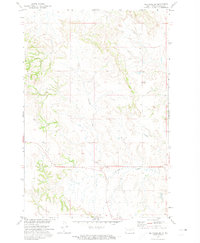
The winding course of Oak Creek defines the landscape of this high-plains region, where the state boundary between North Dakota and South Dakota meets the line separating Sioux and Corson Counties. The map records a sparsely populated agricultural and ranching environment during the mid-1960s, punctuated by isolated community landmarks like the Goose Camp Sch in the northern portion of the quadrangle. Transportation through the area is dominated by the Chicago Milwaukee St Paul and Pacific railroad, which cuts through the southwestern corner, reflecting the vital role of rail in the regional economy. The township of Lincoln spans a significant portion of the southern terrain, where the undulating prairie is marked by a network of unimproved roads and intermittent drainage patterns that speak to the arid character of the northern plains.
Find a feature on this map
6 named features on this map. Tap any name to fly to it.
Don’t see what you’re looking for? This feature index may not catch every label — zoom into the map to look around manually.
Map Details
Editions of this 1966 McLaughlin NE Map
This is the sole edition of this map. No revisions or reprints were ever made.
Other maps of this area

1953 · McIntosh
USGS Topo · 1:250,000

1954 · Bismarck
USGS Topo · 1:250,000

1958 · Bismarck
USGS Topo · 1:250,000

1958 · McIntosh
USGS Topo · 1:250,000

1966 · McLaughlin
USGS Topo · 1:24,000

1966 · Mahto
USGS Topo · 1:24,000

1966 · Mahto NW
USGS Topo · 1:24,000

1968 · Fort Yates
USGS Topo · 1:24,000
1971 · Selfridge SE
USGS Topo · 1:24,000

1971 · Selfridge
USGS Topo · 1:24,000