
1971 Map of Timmer
USGS Topo · Published 1973About this map
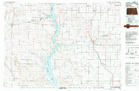
The Standing Rock Indian Reservation Boundary marks a significant division across this prairie landscape, where the Cannonball River meanders through the southern portion of the quadrangle. In the northeast corner, the small settlement of Timmer is anchored by the presence of St George Ch and the adjacent St George Cem. This area reflects the transition from active rail commerce to a different era, as evidenced by the Chicago Milwaukee St Paul and Pacific Railroad Grade cutting across the north. The terrain is defined by the winding paths of Louse Creek and Dogtooth Creek, which drain the open ranch lands of the Harmon and Freda regions. The presence of a solitary Gravel Pit and scattered wells suggests the modest industrial footprint of the time amidst the expansive rural sections.
Find a feature on this map
18 named features on this map. Tap any name to fly to it.
Don’t see what you’re looking for? This feature index may not catch every label — zoom into the map to look around manually.
Map Details
Editions of this 1971 Timmer Map
This is the sole edition of this map. No revisions or reprints were ever made.
Other maps of this area

1954 · Bismarck
USGS Topo · 1:250,000

1958 · Bismarck
USGS Topo · 1:250,000

1971 · Froelich Dam
USGS Topo · 1:24,000

1971 · Shields
USGS Topo · 1:24,000

1971 · Solen SW
USGS Topo · 1:24,000

1971 · Porcupine
USGS Topo · 1:24,000

1980 · Breien
USGS Topo · 1:24,000

1980 · Freda
USGS Topo · 1:24,000

1980 · Burgess
USGS Topo · 1:24,000
1980 · Linton
USGS Topo · 1:100,000