
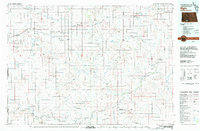
1980 Map of Freda
USGS Topo · Published 1980About this map
The Chicago Milwaukee St Paul and Pacific railroad cuts diagonally across this high plains landscape, serving the small community of Freda and the surrounding grain-growing country. Several Storage Bins clusters are mapped along the tracks, illustrating the vital link between the rail line and the agricultural economy of the Morton and Grant county border. To the northeast of the town site, the Bethesda Cem stands as a primary genealogical landmark for the region.
Find a feature on this map
13 named features on this map. Tap any name to fly to it.
Don’t see what you’re looking for? This feature index may not catch every label — zoom into the map to look around manually.
Map Details
Editions of this 1980 Freda Map
This is the sole edition of this map. No revisions or reprints were ever made.
Other maps of this area

1954 · Bismarck
USGS Topo · 1:250,000

1958 · Bismarck
USGS Topo · 1:250,000

1971 · Shields
USGS Topo · 1:24,000

1971 · Porcupine
USGS Topo · 1:24,000

1971 · Timmer
USGS Topo · 1:24,000

1980 · Burgess
USGS Topo · 1:24,000

1980 · Bell Coulee East
USGS Topo · 1:24,000

1980 · Dogtooth Buttes
USGS Topo · 1:24,000

1980 · Raleigh
USGS Topo · 1:24,000
1980 · Elgin
USGS Topo · 1:100,000