
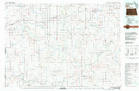
1980 Map of Dogtooth Buttes
USGS Topo · Published 1980About this map
Dogtooth Buttes and the high ridges of Whiskey Buttes dominate this mid-1970s landscape on the border of Grant and Morton counties. The terrain is marked by significant topographical variation, including the notable Deadman Cave and several scattered water wells. Transport and infrastructure are centered on the Burlington Northern railroad line, which cuts through the northern portion of the quadrangle near the headwaters of Louse Creek. The survey, edited in 1980, shows a sparsely populated ranching or agricultural region where life centers on water sources like Otter Creek and the connectivity of the rail corridor. Landmarks such as a Radio Tower and a Roadside Park along the highway provide modern navigation points in a landscape defined by its distinctive buttes and deep creek drainage patterns.
Find a feature on this map
10 named features on this map. Tap any name to fly to it.
Don’t see what you’re looking for? This feature index may not catch every label — zoom into the map to look around manually.
Map Details
Editions of this 1980 Dogtooth Buttes Map
This is the sole edition of this map. No revisions or reprints were ever made.
Other maps of this area

1954 · Bismarck
USGS Topo · 1:250,000

1958 · Bismarck
USGS Topo · 1:250,000

1980 · Otter Creek West
USGS Topo · 1:24,000

1980 · Brisbane
USGS Topo · 1:24,000

1980 · Otter Creek East
USGS Topo · 1:24,000

1980 · Freda
USGS Topo · 1:24,000

1980 · Lark
USGS Topo · 1:24,000

1980 · Raleigh
USGS Topo · 1:24,000

1980 · Nygren Dam
USGS Topo · 1:24,000
1980 · Elgin
USGS Topo · 1:100,000