
1980 Map of Brisbane
USGS Topo · Published 1980About this map
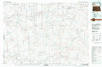
Brisbane serves as a central point of reference in this prairie landscape, where the Chicago Milwaukee St Paul and Pacific railroad cuts a diagonal path across the northern terrain. The map documents the rural infrastructure of the late 1970s, including a local Cem and a power Substa near the rail line. Natural drainage is defined by several watercourses including Sixmile Creek, Twomile Creek, and Louise Creek, which navigate the elevation changes around the Antelope Hills. The area's resource extraction is visible through scattered Gravel Pits and gravel pits, reflecting the practical land use of the era. The presence of the Raleigh Reservoir in the northeast corner provides a critical water source for this Grant County environment, emphasizing the importance of water management in the North Dakota plains.
Find a feature on this map
14 named features on this map. Tap any name to fly to it.
Don’t see what you’re looking for? This feature index may not catch every label — zoom into the map to look around manually.
Map Details
Editions of this 1980 Brisbane Map
This is the sole edition of this map. No revisions or reprints were ever made.
Other maps of this area

1954 · Bismarck
USGS Topo · 1:250,000

1958 · Bismarck
USGS Topo · 1:250,000

1972 · Carson SE
USGS Topo · 1:24,000

1972 · Paradise Flats
USGS Topo · 1:24,000

1980 · Bell Coulee West
USGS Topo · 1:24,000

1980 · Lark
USGS Topo · 1:24,000

1980 · Bell Coulee East
USGS Topo · 1:24,000

1980 · Dogtooth Buttes
USGS Topo · 1:24,000

1980 · Raleigh
USGS Topo · 1:24,000
1980 · Elgin
USGS Topo · 1:100,000