
1972 Map of Carson SE
USGS Topo · Published 1974About this map
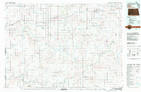
Brisbane sits along the northern edge of this high plains landscape, situated on the route of the Chicago Milwaukee St Paul and Pacific railroad. This 1970s survey captures a transition in the Grant County terrain, where the undulating prairie begins to break toward the Cannonball River valley in the southwest corner. The drainage of Boxelder Creek cuts a path through the central sections of the quadrangle, illustrating the natural watercourses that dictated early settlement and land use. For genealogists and local historians, the presence of the St Vincent Cem in the southeastern quadrant provides a specific point of interest for family research, marking a site of community memory within this sparsely populated rural expanse.
Find a feature on this map
10 named features on this map. Tap any name to fly to it.
Don’t see what you’re looking for? This feature index may not catch every label — zoom into the map to look around manually.
Map Details
Editions of this 1972 Carson SE Map
This is the sole edition of this map. No revisions or reprints were ever made.
Other maps of this area

1954 · Bismarck
USGS Topo · 1:250,000

1958 · Bismarck
USGS Topo · 1:250,000

1972 · Leith
USGS Topo · 1:24,000

1972 · Paradise Flats
USGS Topo · 1:24,000

1972 · Wheeler Hills
USGS Topo · 1:24,000

1980 · Brisbane
USGS Topo · 1:24,000

1980 · Bell Coulee West
USGS Topo · 1:24,000

1980 · Lark
USGS Topo · 1:24,000

1980 · Heil
USGS Topo · 1:24,000
1980 · Elgin
USGS Topo · 1:100,000