
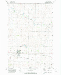
1972 Map of Leith
USGS Topo · Published 1974About this map
Leith serves as the primary hub for this Grant County landscape, situated along the tracks of the Chicago Milwaukee St Paul and Pacific railroad. The region is defined by the winding course of the Cannonball River, which carves through the undulating prairie to the south, joined by Morris Creek. This 1970s survey documents a working landscape where mining and agriculture intersect. Evidence of the area's extraction history is visible in the presence of the Binek Mine, Lahr Mine, and Peterson Mine, all located north of the river. Named landmarks like Spring Hill and the elevated terrain of Elm Rock provide topographic context for researchers and genealogists tracing family land or industrial sites in this portion of the North Dakota plains.
Find a feature on this map
13 named features on this map. Tap any name to fly to it.
Don’t see what you’re looking for? This feature index may not catch every label — zoom into the map to look around manually.
Map Details
Editions of this 1972 Leith Map
This is the sole edition of this map. No revisions or reprints were ever made.
Other maps of this area

1954 · Bismarck
USGS Topo · 1:250,000

1958 · Bismarck
USGS Topo · 1:250,000

1972 · Carson SE
USGS Topo · 1:24,000

1972 · Paradise Flats
USGS Topo · 1:24,000

1972 · Wheeler Hills
USGS Topo · 1:24,000

1972 · Pretty Rock Butte
USGS Topo · 1:24,000

1972 · Sheep Creek Dam
USGS Topo · 1:24,000

1980 · Heil
USGS Topo · 1:24,000
1980 · Elgin
USGS Topo · 1:24,000
1980 · Elgin
USGS Topo · 1:100,000