
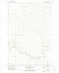
1972 Map of Pretty Rock Butte
USGS Topo · Published 1974About this map
Pretty Rock Butte and the surrounding high plains of Grant County are captured here during the early 1970s. The landscape is defined by its topographic high points and the seasonal watercourses that drain them, including Morris Creek, Snake Creek, and Brush Creek. A sense of the local community center is visible at the Townhall, while the presence of the Pretty Rock Cem provides a focal point for genealogical research in this sparsely populated township. Notable landmarks like Beer Bum Hill and Round Top stand out as distinct physical markers against the section-line roads that organize the prairie. The map reflects a quiet era of North Dakota ranching and farming, where distance between neighbors was measured by these named buttes and intermittent stream beds.
Find a feature on this map
10 named features on this map. Tap any name to fly to it.
Don’t see what you’re looking for? This feature index may not catch every label — zoom into the map to look around manually.
Map Details
Editions of this 1972 Pretty Rock Butte Map
This is the sole edition of this map. No revisions or reprints were ever made.
Other maps of this area

1954 · Bismarck
USGS Topo · 1:250,000

1958 · Bismarck
USGS Topo · 1:250,000

1972 · Leith
USGS Topo · 1:24,000

1972 · Wheeler Hills
USGS Topo · 1:24,000

1972 · Coffin Buttes
USGS Topo · 1:24,000

1972 · New Leipzig South
USGS Topo · 1:24,000

1972 · Sheep Creek Dam
USGS Topo · 1:24,000

1972 · Pretty Rock Butte SE
USGS Topo · 1:24,000

1972 · Round Top
USGS Topo · 1:24,000
1972 · Parks Hills
USGS Topo · 1:24,000