
1972 Map of New Leipzig South
USGS Topo · Published 1974About this map
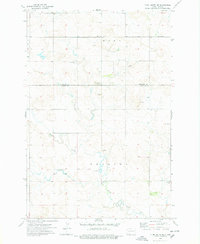
Cannonball River meanders through this landscape in southern North Dakota, defining the drainage patterns south of New Leipzig. The early 1970s environment is characterized by a mix of agricultural land and early industrial activity, evidenced by several Strip Mines and a Gravel Pit scattered across the northern sections. Along the southern edge of the survey, the Pretty Rock National Wildlife Refuge provides a preserved area near Sheep Creek. Transportation through the region is anchored by the Chicago Milwaukee St Paul and Pacific railroad, which runs parallel to the northern border. For those researching local family history, this map is exceptionally detailed regarding burial sites, specifically identifying the Congregation Cem, St Johns Cem, Immanuel Cem, Finnish Cem, and Fleak Cem, reflecting the diverse settlement patterns of the early 20th century.
Find a feature on this map
21 named features on this map. Tap any name to fly to it.
Don’t see what you’re looking for? This feature index may not catch every label — zoom into the map to look around manually.
Map Details
Editions of this 1972 New Leipzig South Map
This is the sole edition of this map. No revisions or reprints were ever made.
Other maps of this area

1953 · Dickinson
USGS Topo · 1:250,000

1954 · Bismarck
USGS Topo · 1:250,000

1957 · Dickinson
USGS Topo · 1:250,000

1958 · Bismarck
USGS Topo · 1:250,000

1969 · North Star Butte
USGS Topo · 1:24,000

1969 · Bentley
USGS Topo · 1:24,000

1972 · Coffin Buttes
USGS Topo · 1:24,000

1972 · Pretty Rock Butte
USGS Topo · 1:24,000

1972 · Sheep Creek Dam
USGS Topo · 1:24,000
1974 · Plum Butte NE
USGS Topo · 1:24,000