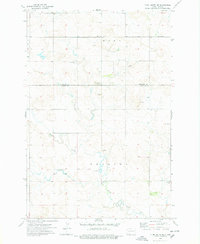
1974 Map of Plum Butte NE
USGS Topo · Published 1978About this map
Sacred Heart Cem and Pilgerheim Cem mark the rural upland landscape of the High Plains during the mid-1970s. This survey, compiled from 1973 aerial photography, documents the border between Hettinger and Adams Counties in southwest North Dakota. The drainage patterns of Timber Creek and Sheep Creek define the topography, while local education is anchored at the Beisigl Sch in the southern portion of the quadrangle. Resource extraction is a visible part of the local economy, evidenced by several scattered workings including a Strip Mine, a Scoria Pit, and various Gravel Pits. The map provides a precise look at section lines, rural roads, and farmstead locations before the widespread consolidation of the late 20th century.
Find a feature on this map
12 named features on this map. Tap any name to fly to it.
Don’t see what you’re looking for? This feature index may not catch every label — zoom into the map to look around manually.
Map Details
Editions of this 1974 Plum Butte NE Map
This is the sole edition of this map. No revisions or reprints were ever made.
Other maps of this area

1953 · Dickinson
USGS Topo · 1:250,000

1954 · Bismarck
USGS Topo · 1:250,000

1957 · Dickinson
USGS Topo · 1:250,000

1958 · Bismarck
USGS Topo · 1:250,000

1969 · Burt
USGS Topo · 1:24,000

1969 · Bentley
USGS Topo · 1:24,000

1972 · Coffin Buttes
USGS Topo · 1:24,000

1972 · New Leipzig South
USGS Topo · 1:24,000

1972 · Round Top
USGS Topo · 1:24,000
1974 · Nason Hill
USGS Topo · 1:24,000